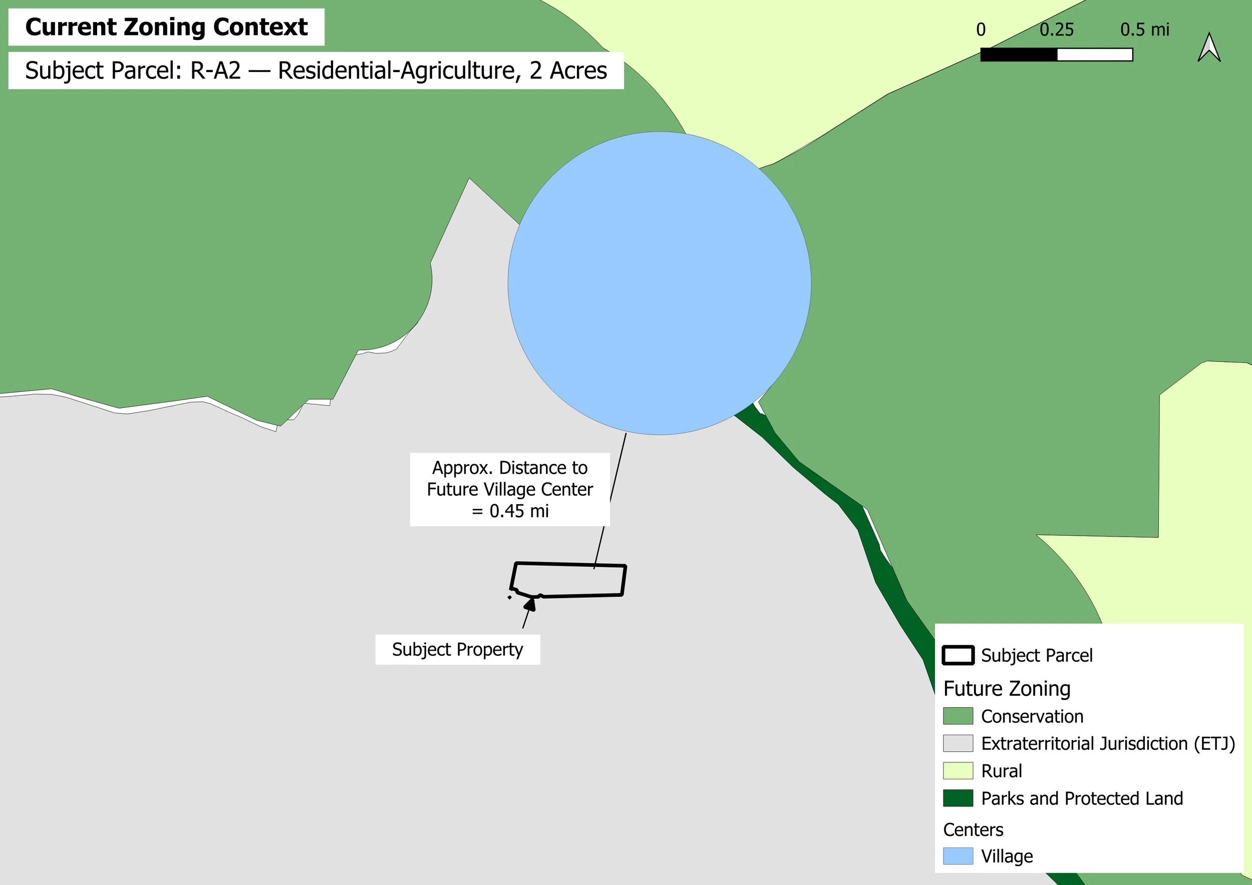
Future Land Use & Planning Context
See how a property fits within the larger planning picture. This analysis
places the parcel in its jurisdictional and future land-use context and
identifies nearby planning features that may influence longer-term land
use and development. In this example, the parcel lies within the Pittsboro
ETJ and approximately 0.45 mile from a mapped future Village Center.
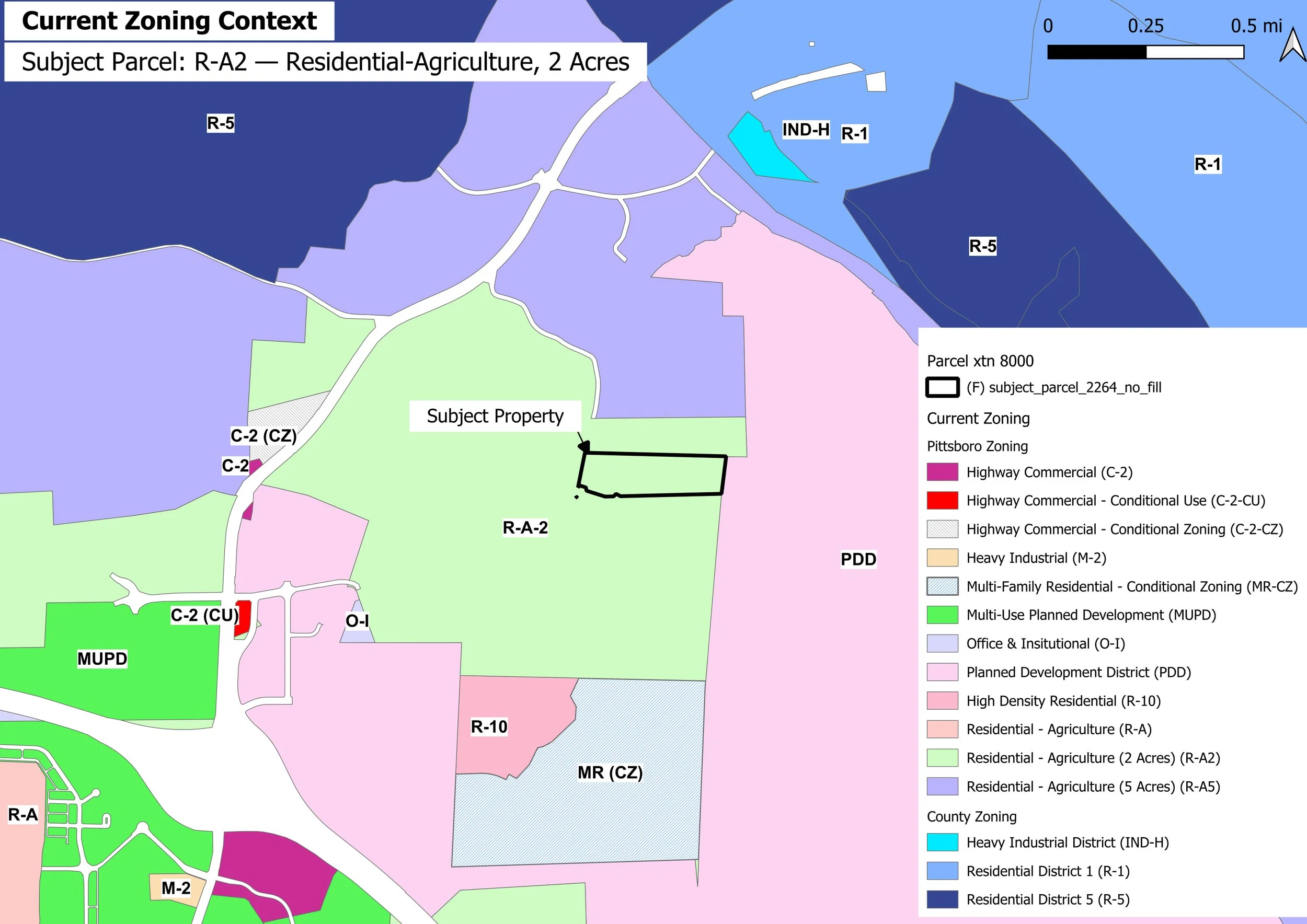
Current Zoning Context
Understand how a property's current zoning relates to the surrounding
land-use pattern. This exhibit identifies the subject parcel's mapped
zoning classification and places it alongside nearby zoning districts
that may be relevant to development, compatibility, and future site
evaluation.
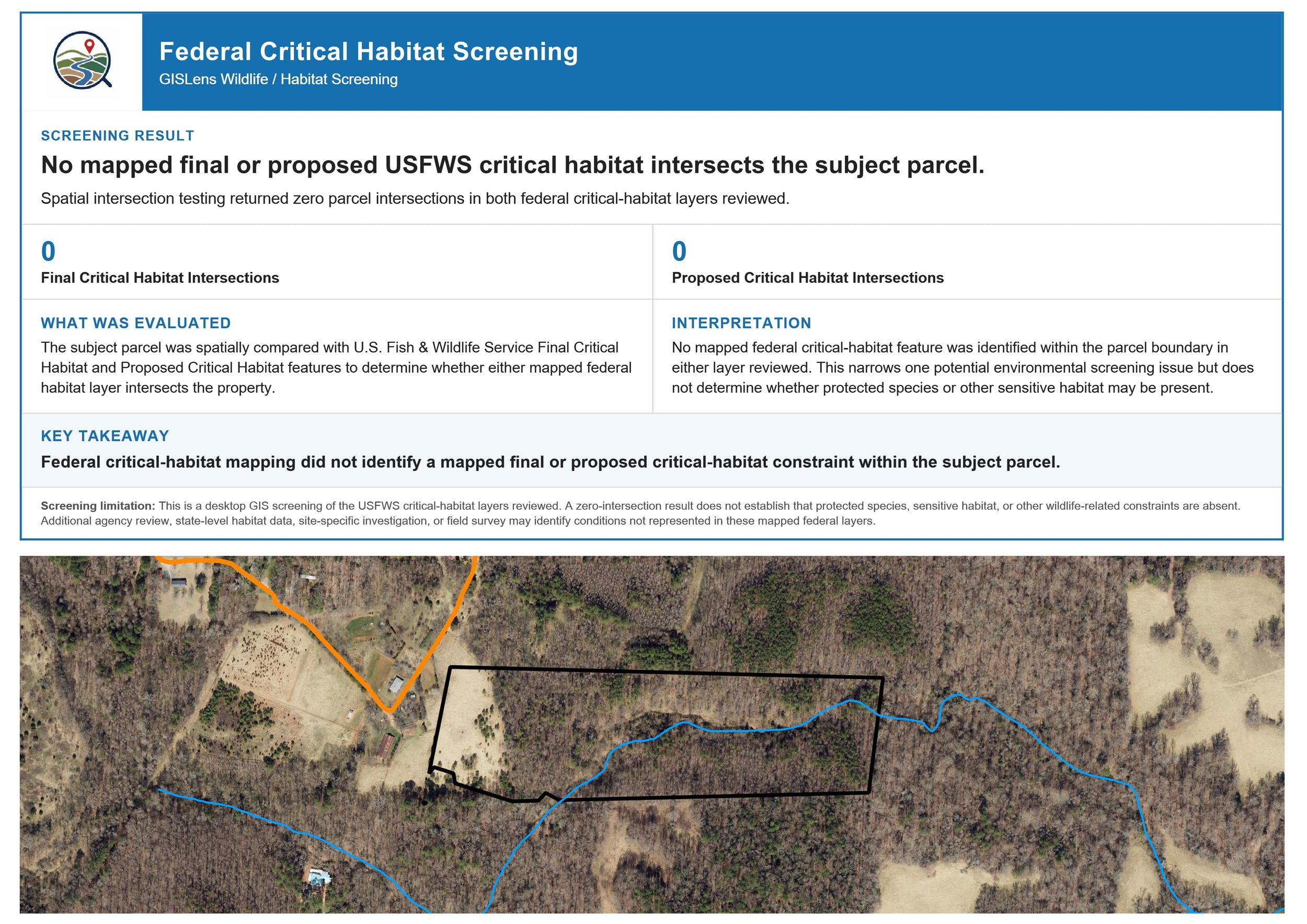
Wildlife & Habitat Screening
Identify mapped wildlife and habitat considerations that may warrant closer
review. This screening compares the property with available protected-resource
and critical-habitat data to help flag potential environmental concerns early
in the evaluation process. In this example, no mapped final or proposed USFWS
critical habitat intersects the subject parcel.