
GISLens · Portfolio demonstration
Oak Hollow
A property constraint screening for a small residential development in Virginia. Explore the maps, key findings and next investigations.
Abbreviated from the 73-page report. Identifying names, county and source references are fictionalized; source references are inactive. Maps and findings derive from a real study.
Property Overview
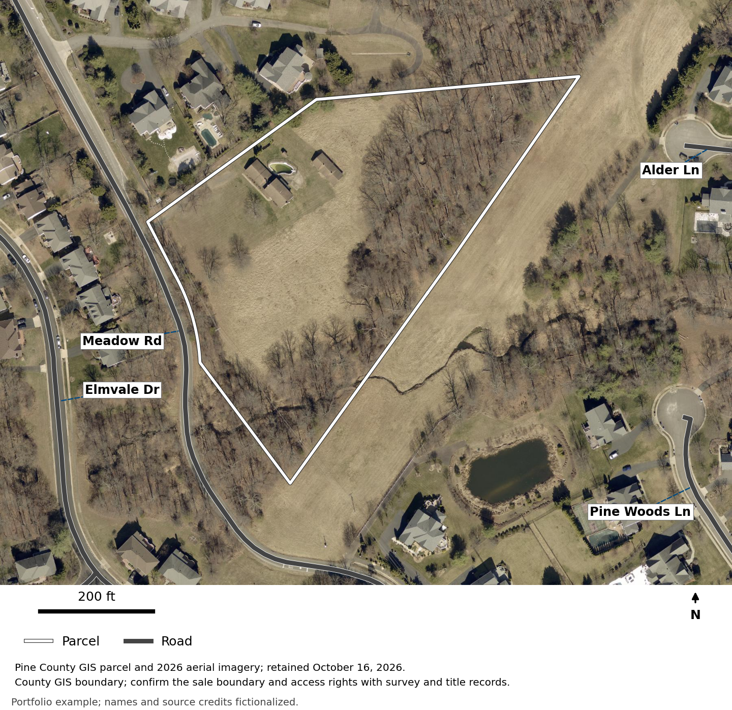
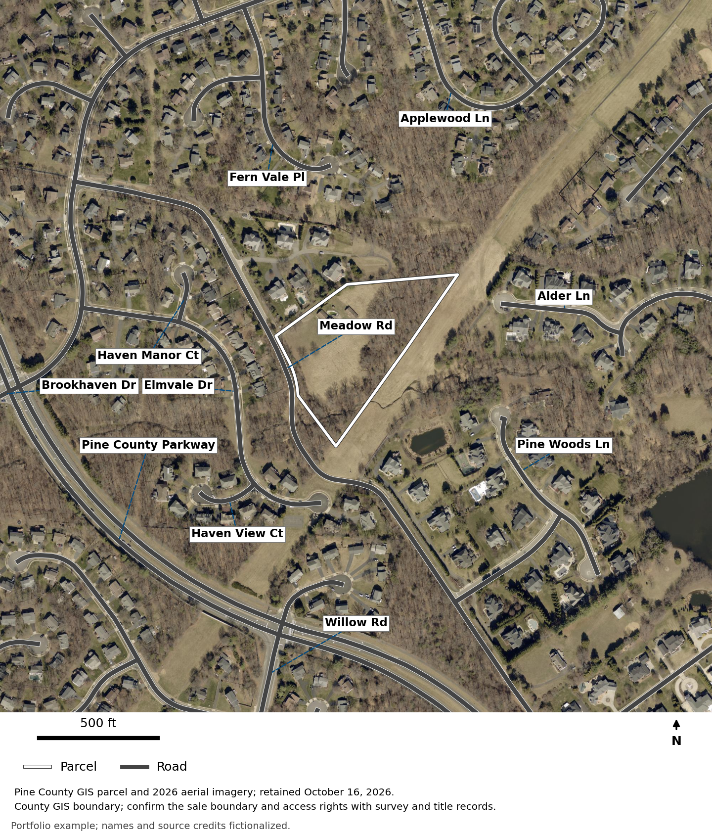
A small residential-development screening of one parent parcel.
Key takeaways
- 6.4 acres recorded; 6.06 acres mapped. Next: Confirm the sale boundary, acreage and access through survey and title review.
- The county record identifies an existing home. Next: Confirm present improvements and define the proposed development scope.
Download the full report: property records and screening boundary.
Zoning and Future Land Use
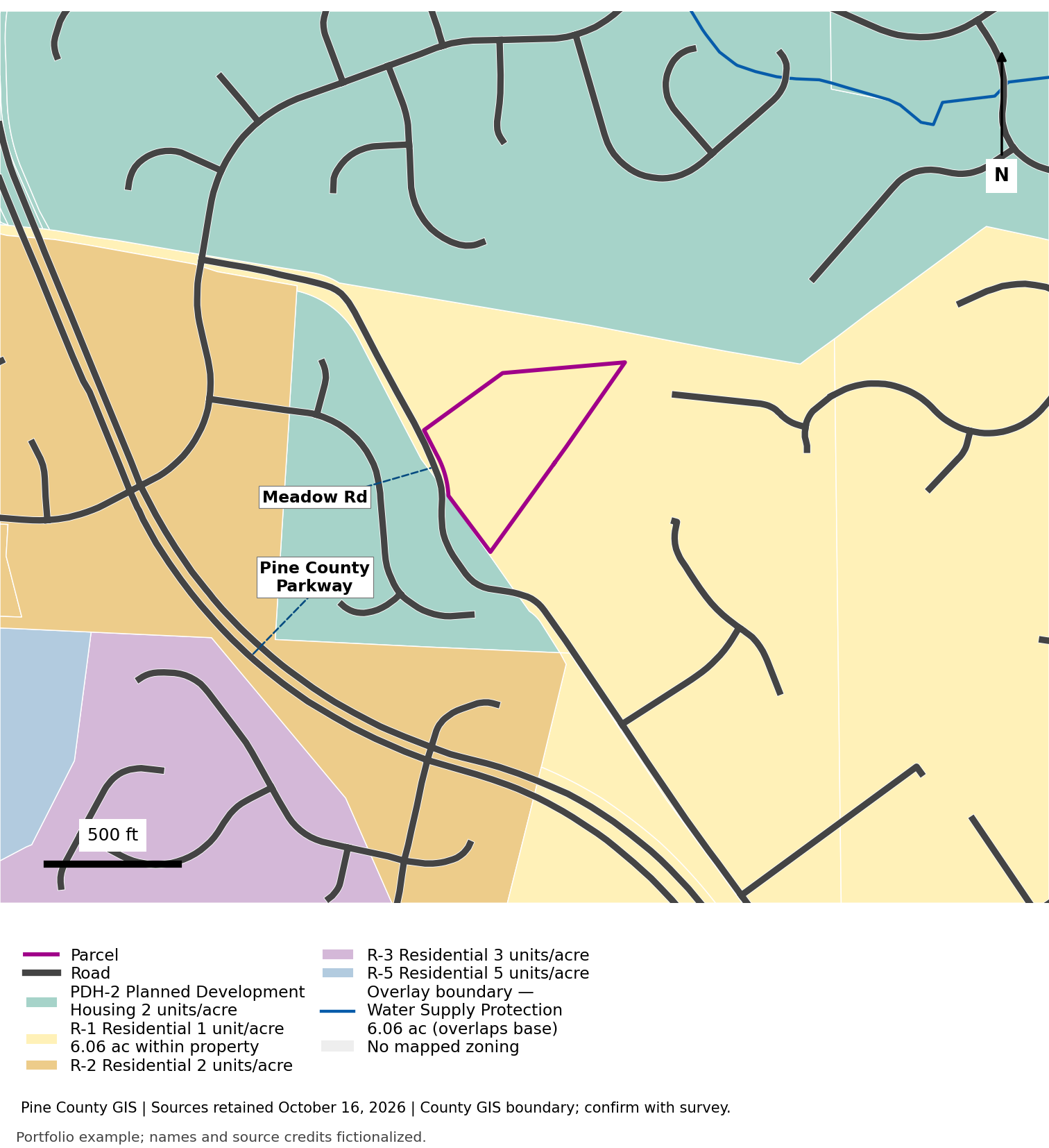
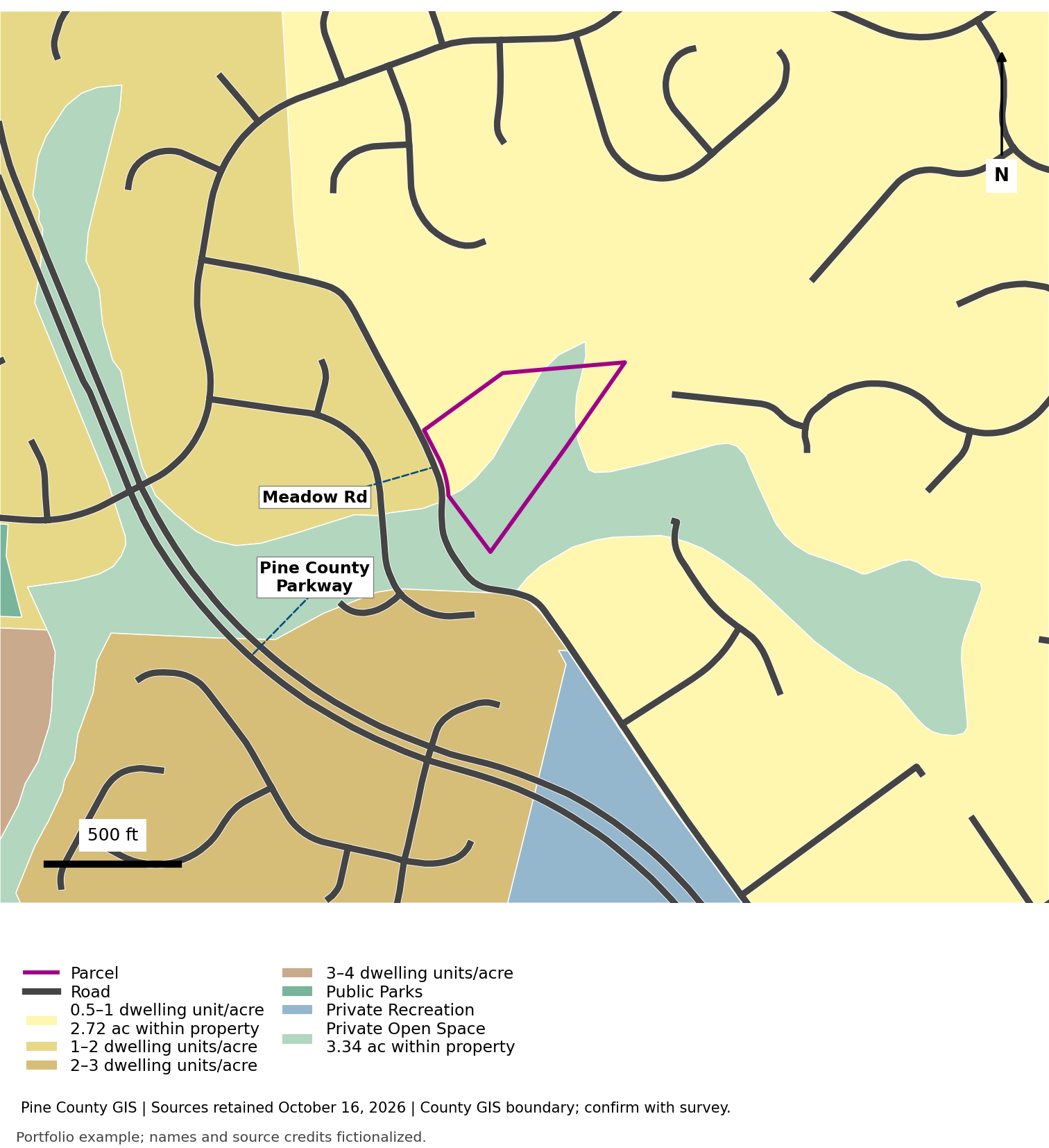
Zoning and planning policy raise different questions for the proposed homes.
Key takeaways
- R-1 zoning and a water-supply protection overlay cover the parcel. Next: Confirm applicable subdivision and water-quality requirements with planning staff.
- The plan divides the property between residential use and Private Open Space. Next: Resolve that split before estimating a home count or commissioning a layout.
Download the full report: planning standards and policy details.
Wetlands and Surface Water
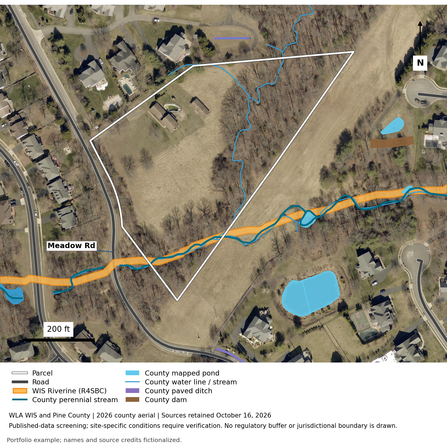
Published water features cross the parcel; stream classifications differ between sources.
Key takeaways
- County records identify perennial streams; the older inventory uses an intermittent-stream category. Next: Reconcile the records with field delineation and county review before locating roads or buildings.
Download the full report: water-feature classifications and source dates.
Flood Hazards
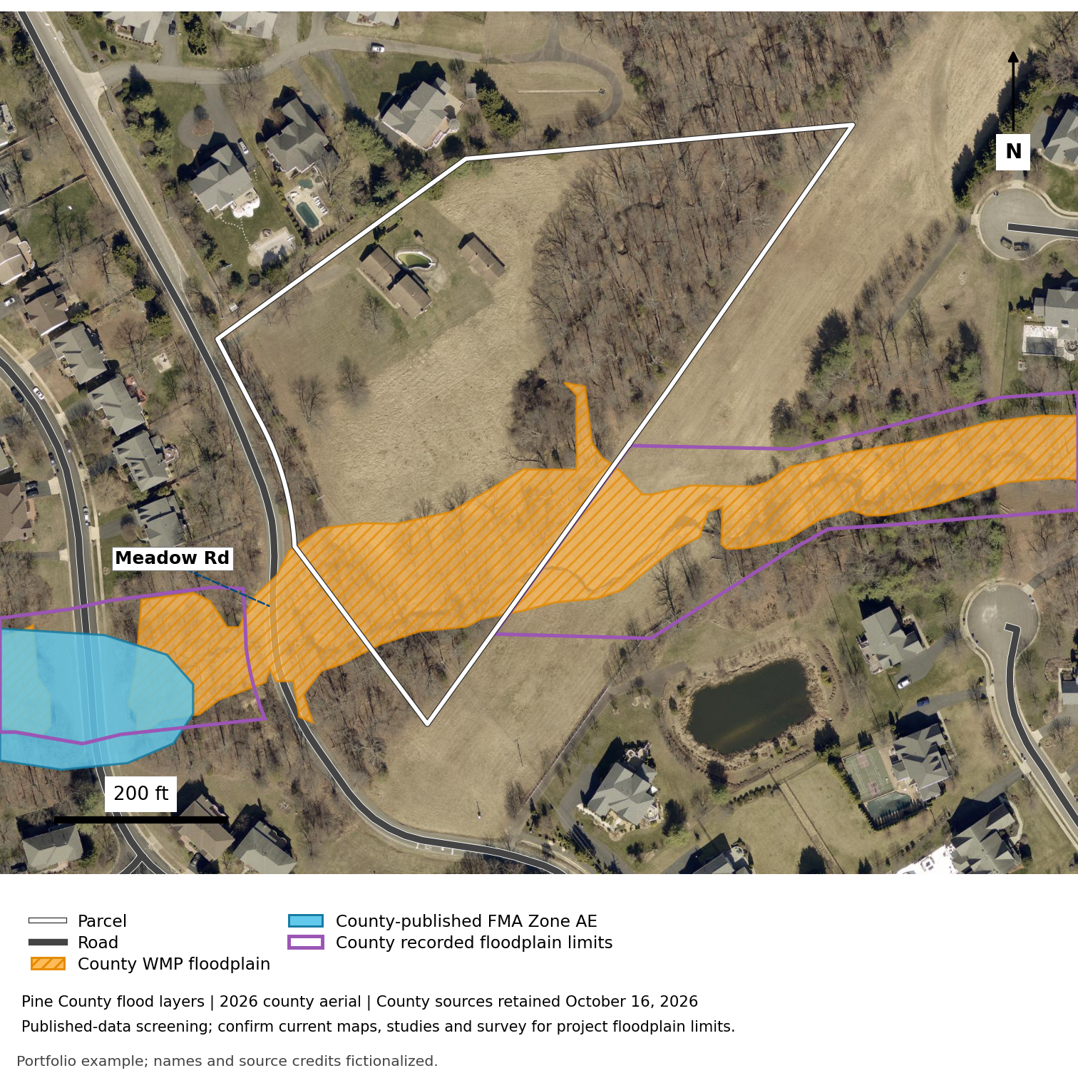
County planning floodplain mapping crosses the parcel, while a dated state snapshot places it in Zone X.
Key takeaways
- The sources serve different purposes and do not establish project flood clearance. Next: Confirm effective flood maps, applicable map-change letters and county studies against a current survey.
Download the full report: flood records, dates and limitations.
Terrain and Slope
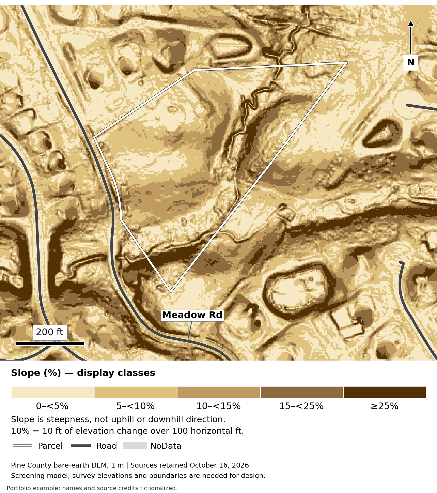
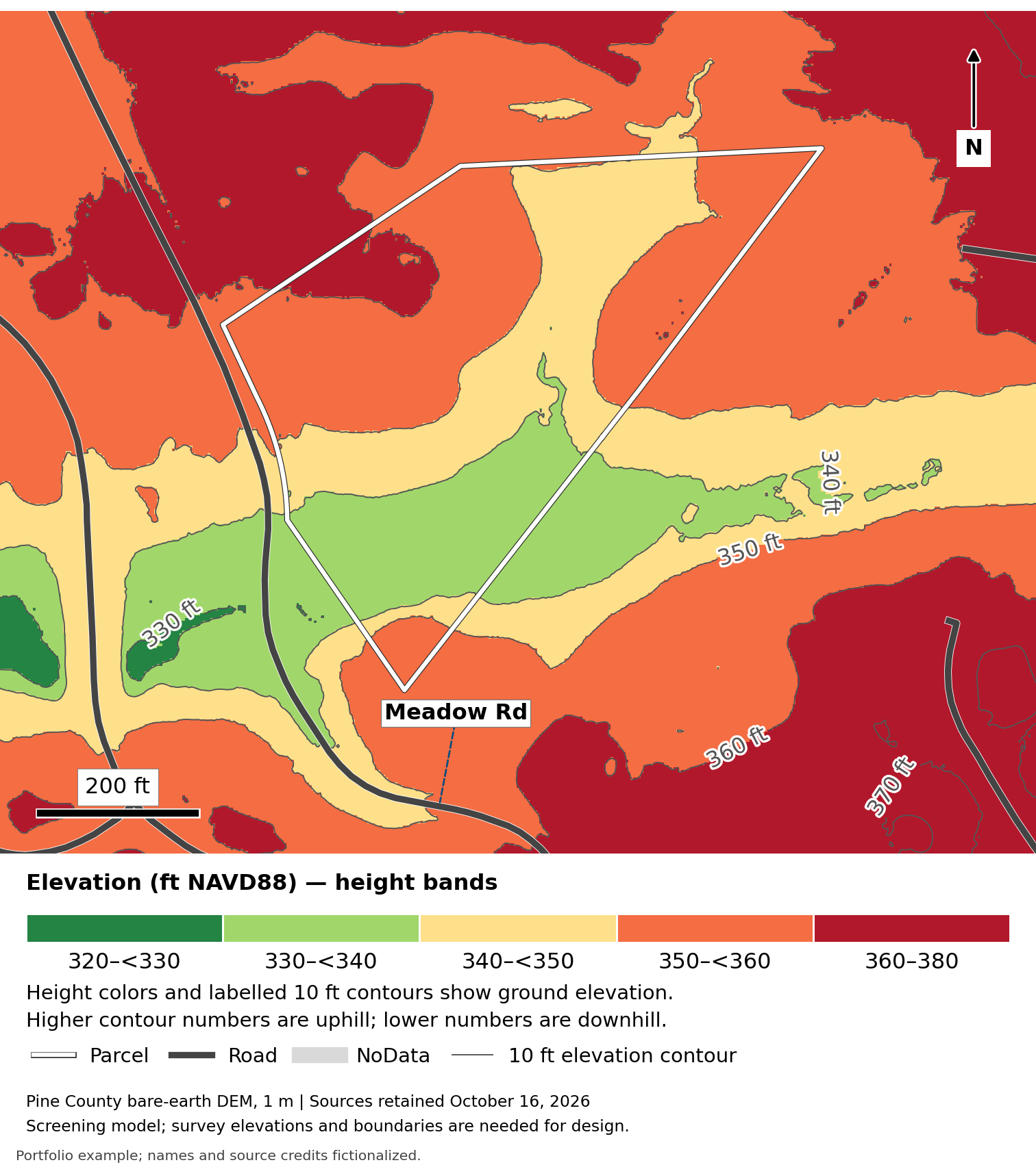
The property contains gentler ground and steeper pockets; sampled elevations are approximately 330–362 feet.
Key takeaways
- The elevation grid helps frame access, grading and drainage questions. Next: Obtain survey elevations and field checks before fixing roads, building levels or earthwork assumptions.
Download the full report: terrain methods and map-reading guidance.
Water Supply and Wastewater Screening
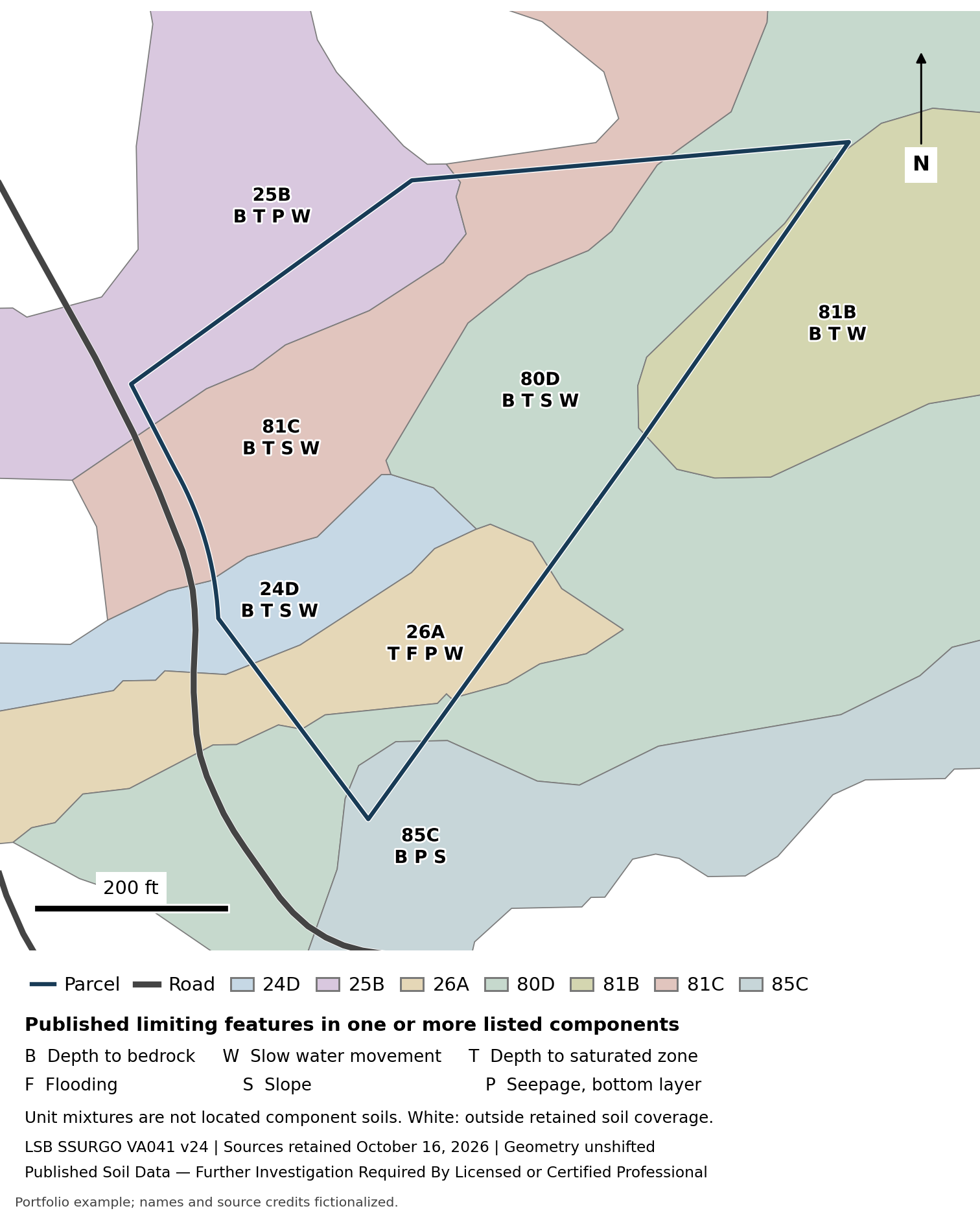
Public water is a potential option; sewer service for the proposed homes remains unconfirmed.
Key takeaways
- Published service descriptions conflict. Next: Obtain separate written water and sewer responses for the intended development.
- An existing septic record and well point do not confirm capacity for new homes. Next: Obtain approved records and qualified site evaluation.
- Every returned soil component is rated Very limited for septic absorption fields; 10–20% of mixtures is unrepresented. Next: Use the published limitations to focus professional investigation, not to determine septic approval.
Published Soil Data — Further Investigation Required By Licensed or Certified Professional. Map units represent soil mixtures; ratings do not establish site-specific suitability or approval.
Download the full report: service records, published charges and septic component tables.
Soil Wetness and Drainage
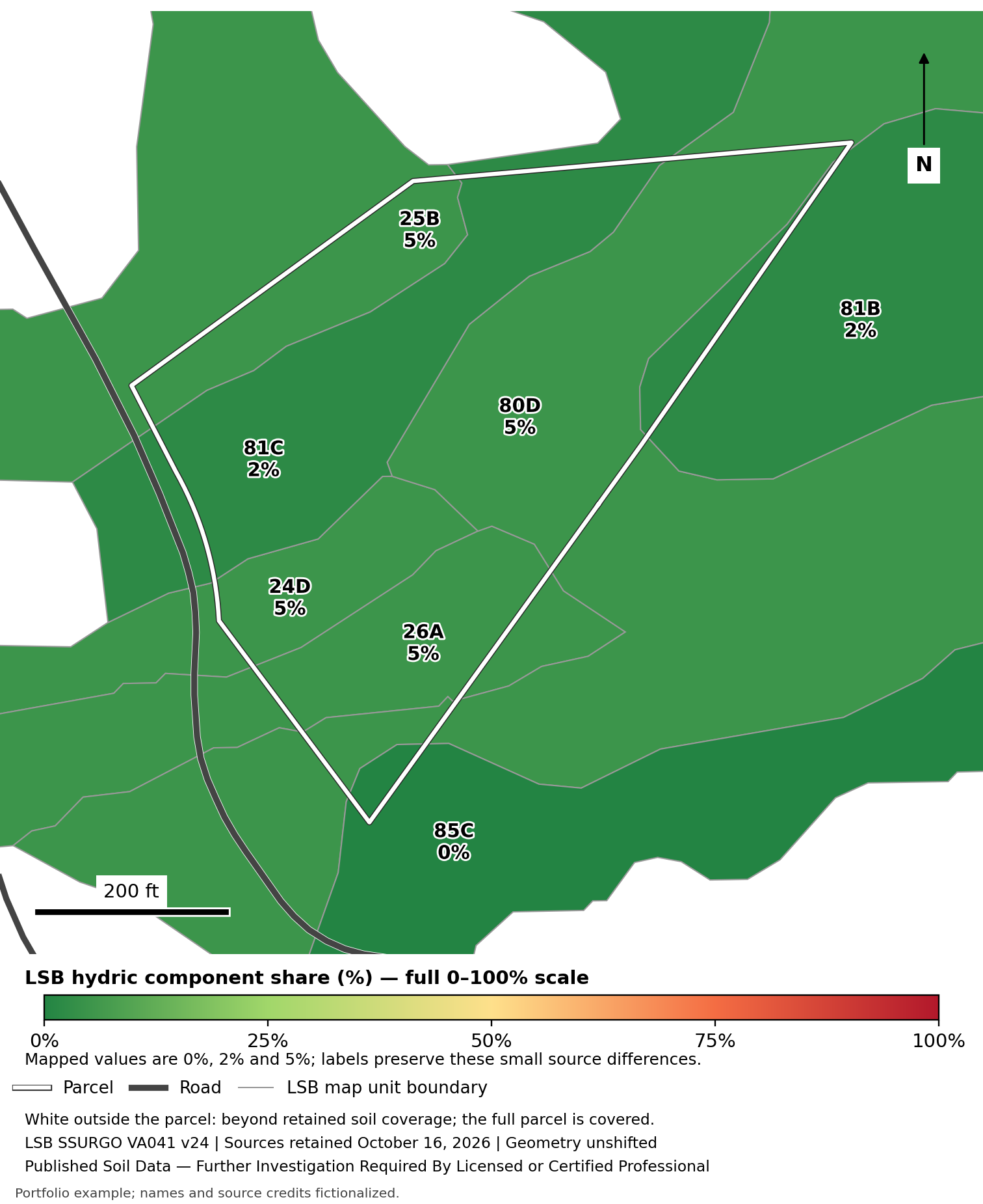
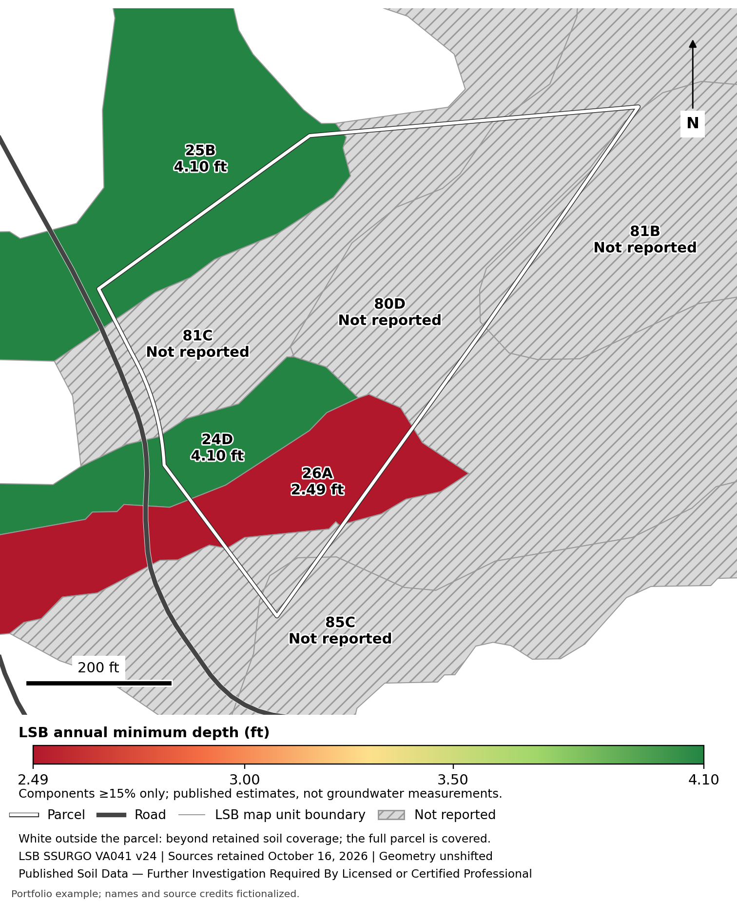
Dominant drainage classes do not describe every component within a mapped soil unit.
Key takeaways
- Six units also include small Poorly drained components; four lack annual depth values. Next: Investigate minor wet components and missing values onsite. Hydric shares are not wetland acreage.
Published Soil Data — Further Investigation Required By Licensed or Certified Professional. Map units represent soil mixtures; ratings do not establish site-specific suitability or approval.
Download the full report: soil-unit mixtures, drainage classes and depth tables.
Building Soil Conditions With and Without Basements
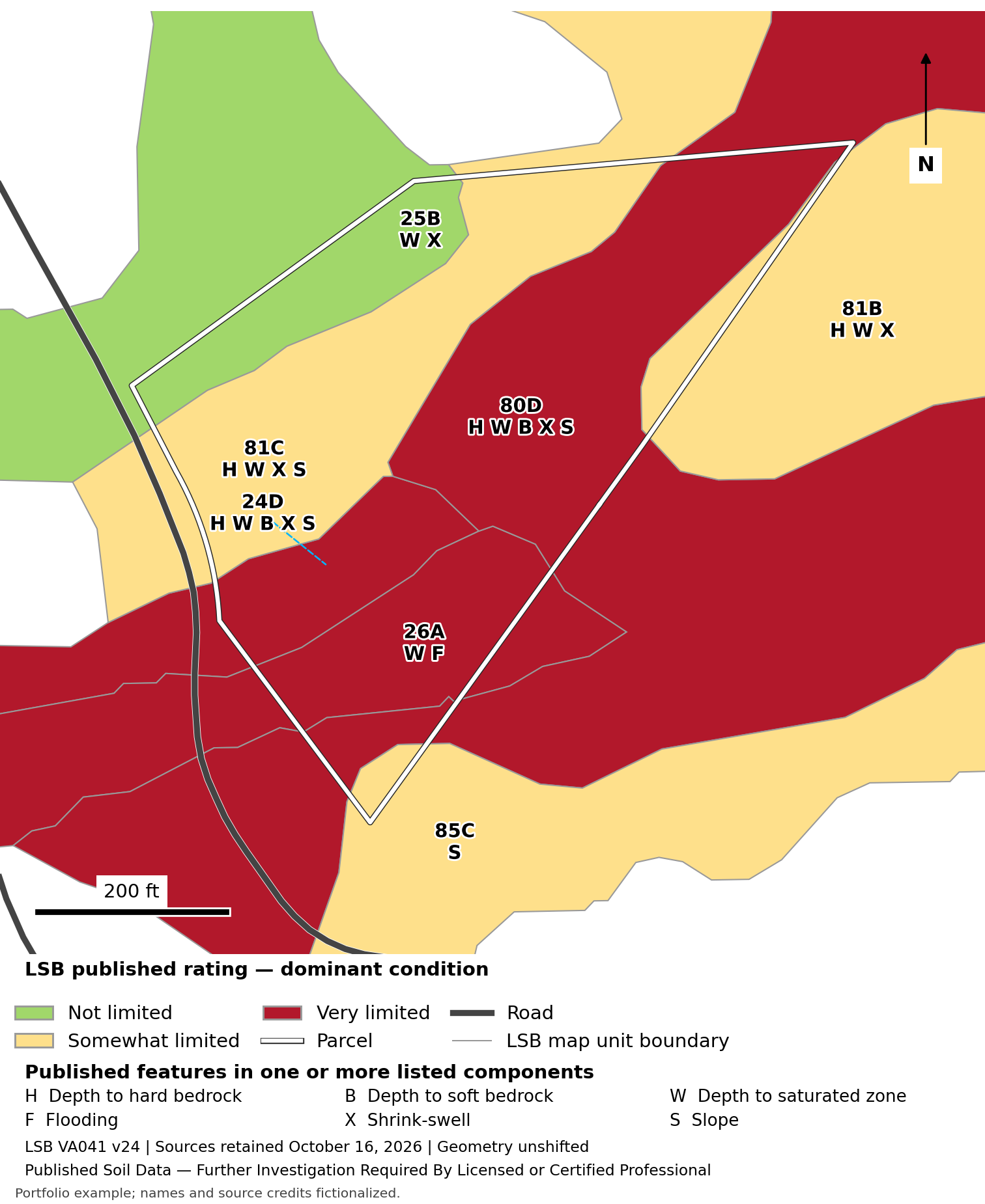
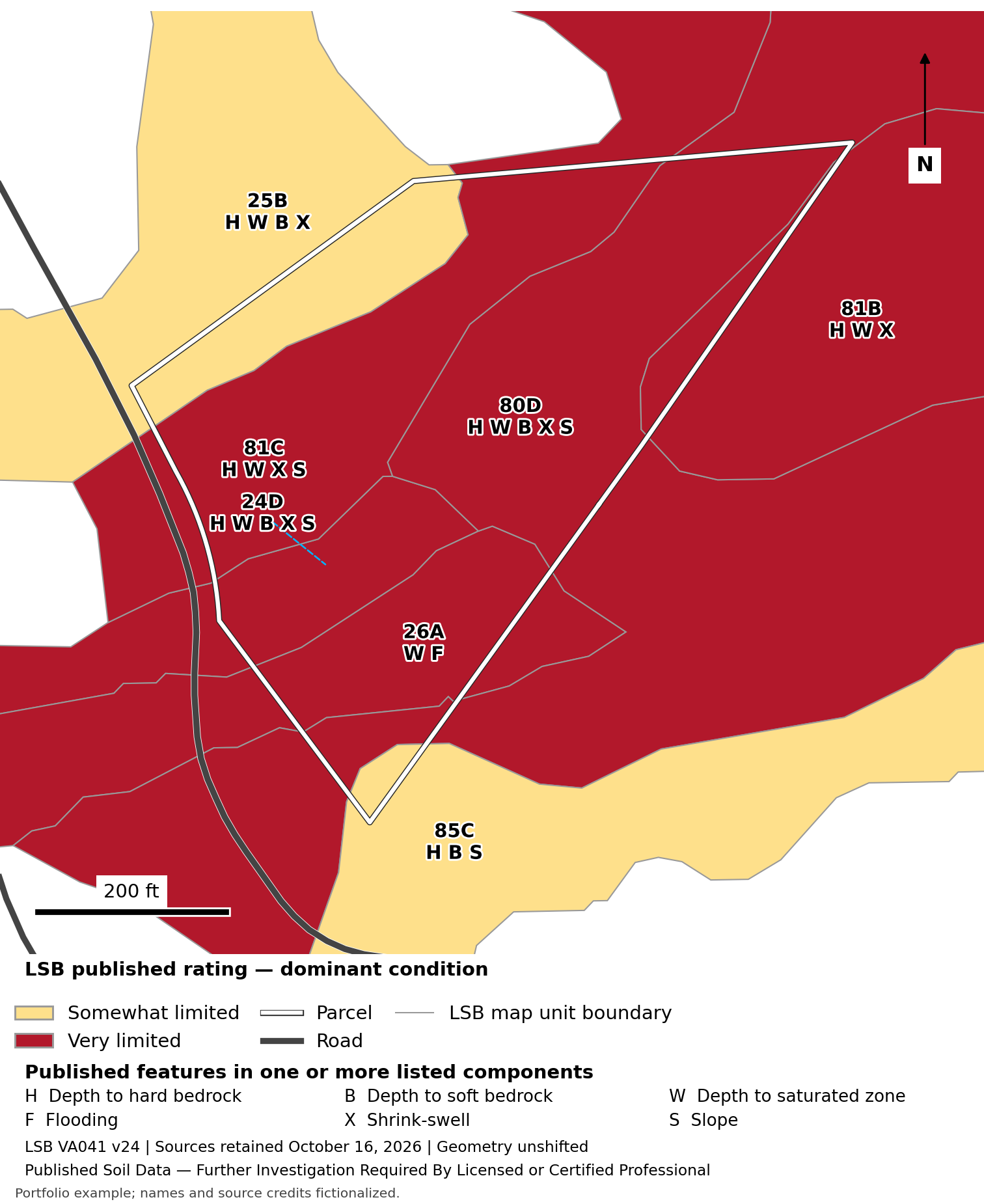
The published basement scenario increases limitations in several soil units.
Key takeaways
- Some units remain Very limited in both scenarios; smaller components and unknown shares still matter. Next: Have a geotechnical professional evaluate soil, rock, moisture and excavation conditions for the intended design.
Published Soil Data — Further Investigation Required By Licensed or Certified Professional. Map units represent soil mixtures; ratings do not establish site-specific suitability or approval.
Download the full report: building-soil ratings, assumptions and component tables.
Clearing and Erosion
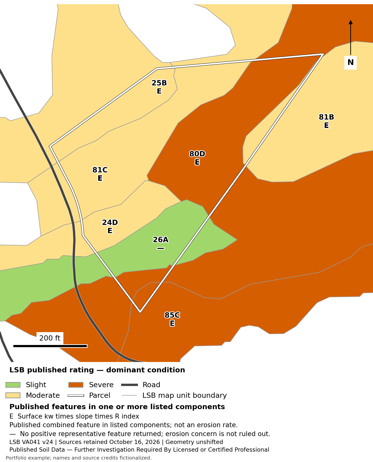
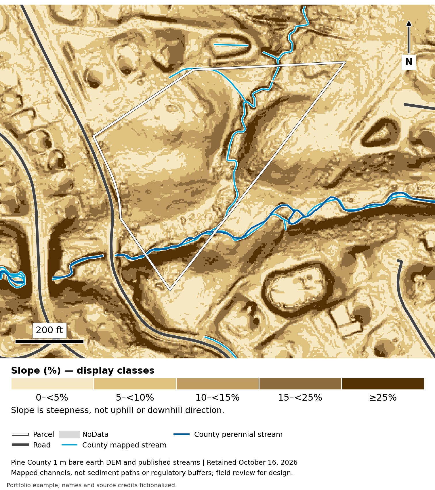
Published erosion ratings range from Slight to Severe; streams and steeper terrain add planning questions.
Key takeaways
- Soil ratings describe a reference scenario, not predicted construction sediment loss. Next: Coordinate survey, drainage, clearing limits and erosion controls; confirm disturbance requirements before clearing.
Published Soil Data — Further Investigation Required By Licensed or Certified Professional. Map units represent soil mixtures; ratings do not establish site-specific suitability or approval.
Download the full report: erosion component tables and disturbance guidance.
Wildlife and Habitat
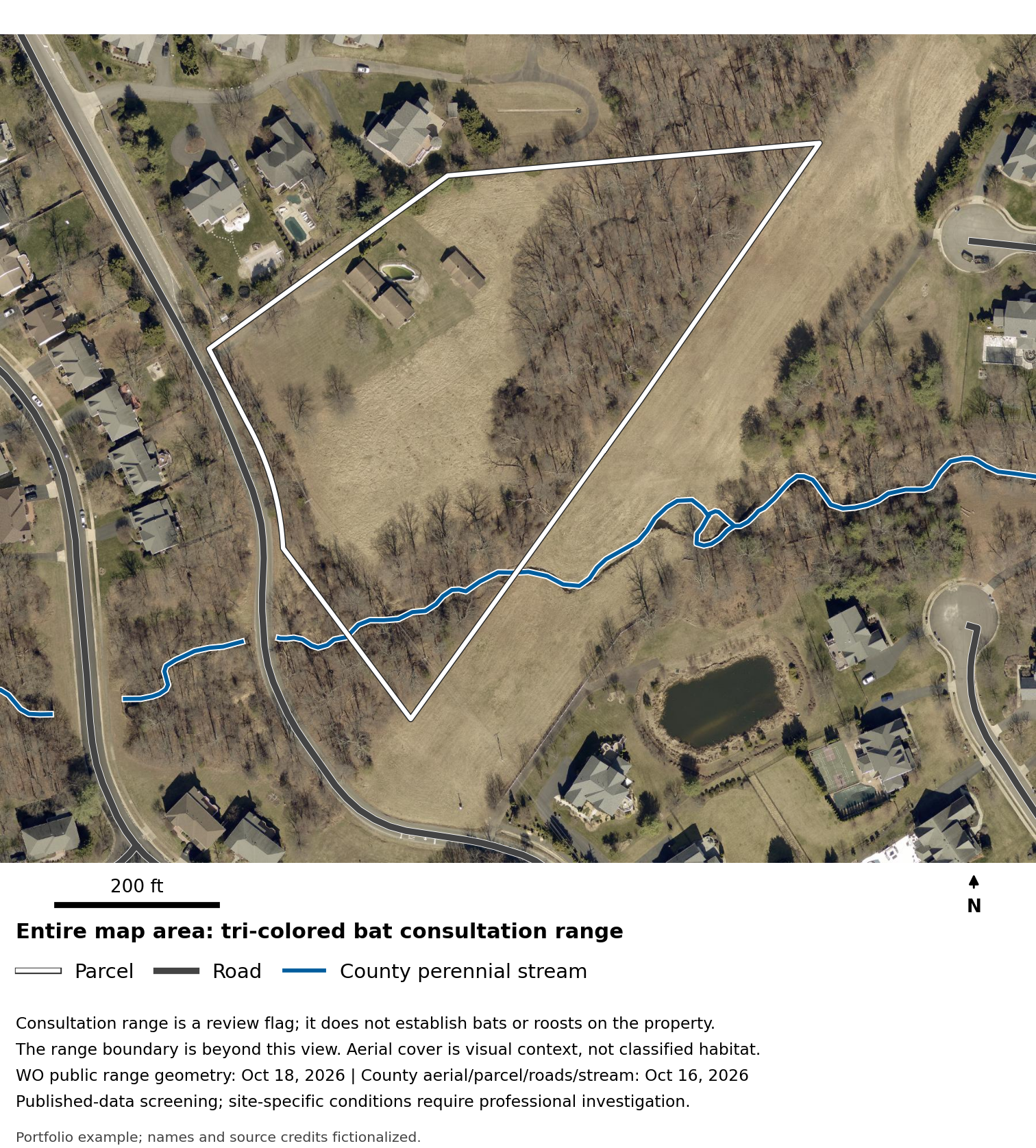
The published tri-colored bat consultation range intersects the parcel.
Key takeaways
- Empty results in selected habitat layers do not establish species absence. Next: Have a biologist assess the full action area, trees, proposed clearing and current agency-review requirements.
Download the full report: species checks, source coverage and review limitations.
Local Policies and Special Constraints
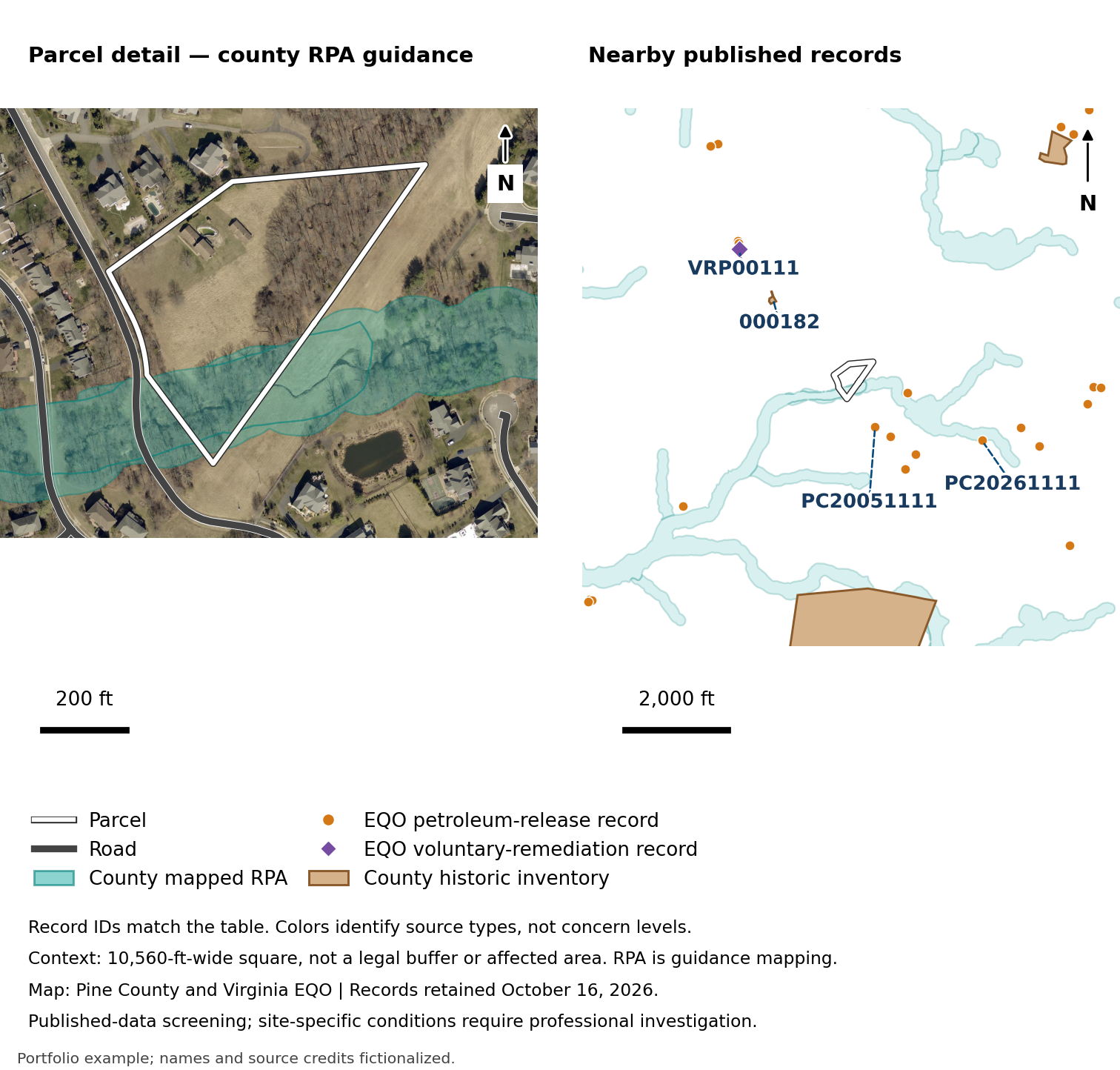
County Resource Protection Area guidance crosses the property; separate water-quality requirements also apply.
Key takeaways
- Mapped protection guidance requires site-specific boundary and project review. Next: Resolve it with county staff before defining disturbance limits.
- Nearby environmental records lie outside the parcel. Next: Have an environmental professional review relevant files; proximity and case status do not establish this property’s condition.
Download the full report: policy details, environmental records and source checks.
Ground Hazards
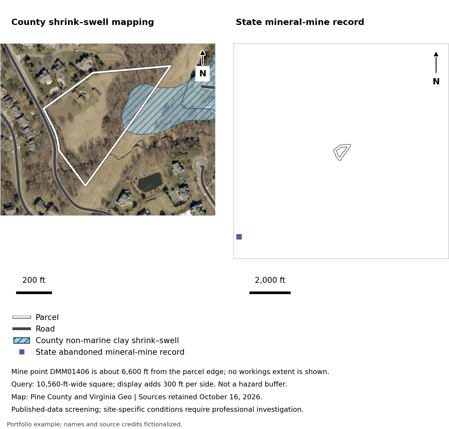
County mapping flags clay shrink–swell within the eastern parcel.
Key takeaways
- A separate abandoned-mine record is approximately 6,600 feet away. Neither proximity nor empty inventories determines site stability. Next: Scope site-specific geotechnical work and any geological-record review warranted by the proposal.
Download the full report: ground-hazard inventories, geology and radon context.
Surrounding Land Use Compatibility
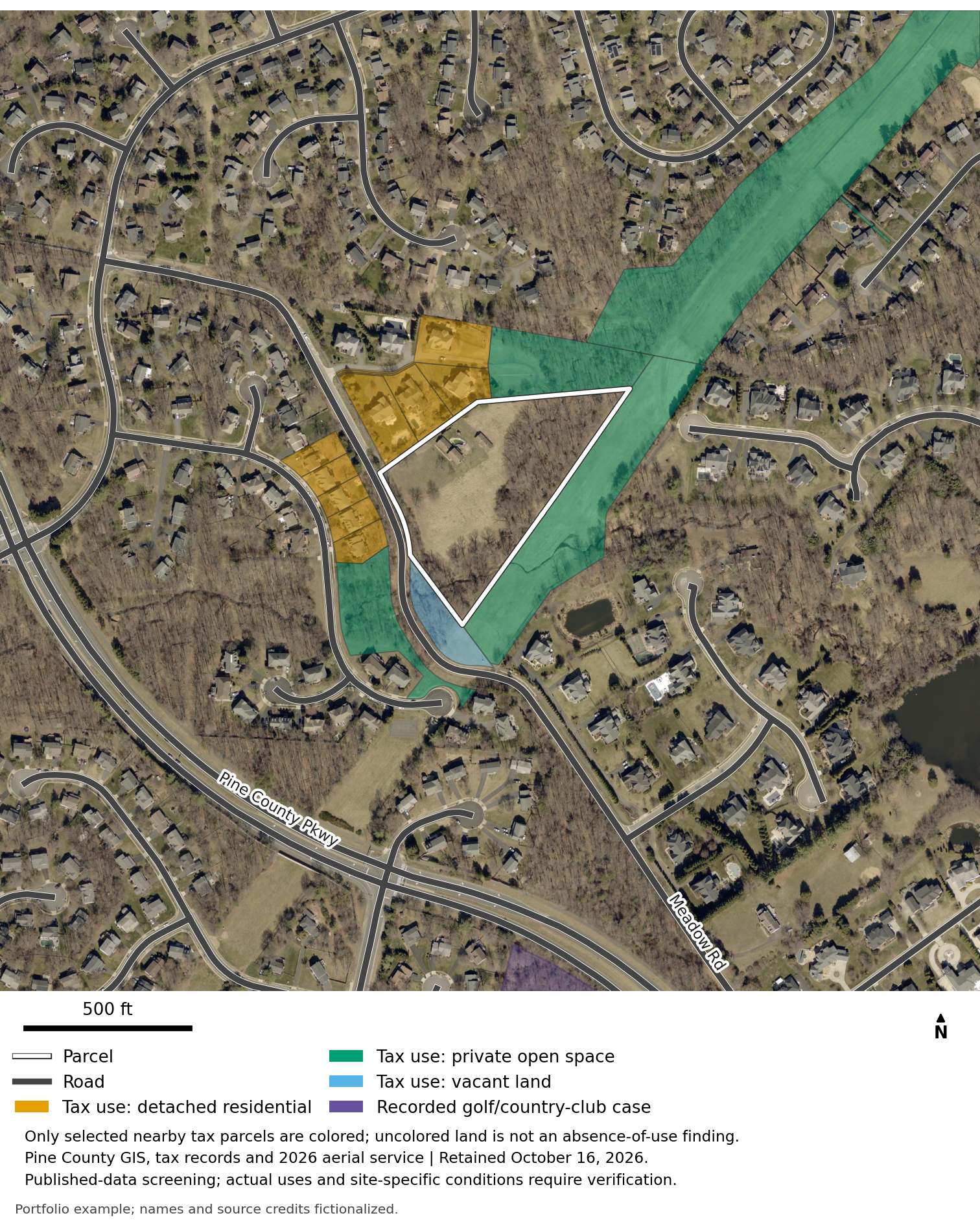
Nearby records describe homes, private open space and vacant land, with a separate golf/country-club approval nearby.
Key takeaways
- A linear clearing raises an unresolved infrastructure and title question. Next: Confirm actual neighboring uses, easements and utility rights before refining the layout; mapped categories do not predict impacts.
Download the full report: nearby parcel records, activity leads and utility contacts.
Actions and Next Steps
The findings become an investigation sequence. Priorities indicate order, not severity; tasks within each priority are tied.
Priority 1
Resolve planning, boundaries and title; confirm water and wastewater options; establish stream, wetland, flood and protection-area review requirements.
Priority 2
Coordinate survey, drainage, grading, erosion, foundations, environmental-file review and habitat work. Start material purchase-record checks early, alongside Priority 1.
Priority 3
Confirm adjoining uses, infrastructure rights and energy-service requirements as the concept develops. This order does not imply a smaller potential impact.
Download the full report for the complete action briefs and property contacts.