
GISLens · Sample Report
Pine Ridge
A residential-development screening of two adjoining parcels. Explore the maps, key findings and next investigations.
Abbreviated from the 70-page report. Identifying names, addresses, county and source references are fictionalized; source references are inactive. Maps and findings derive from a real study.
Property Overview
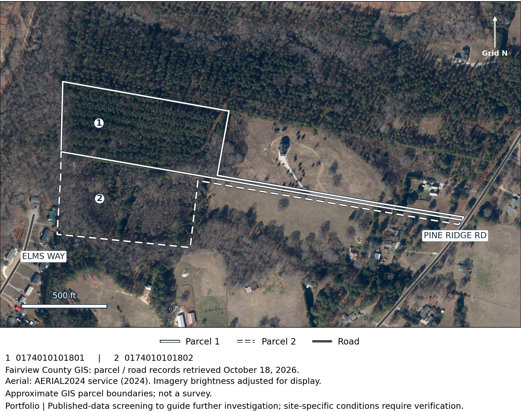
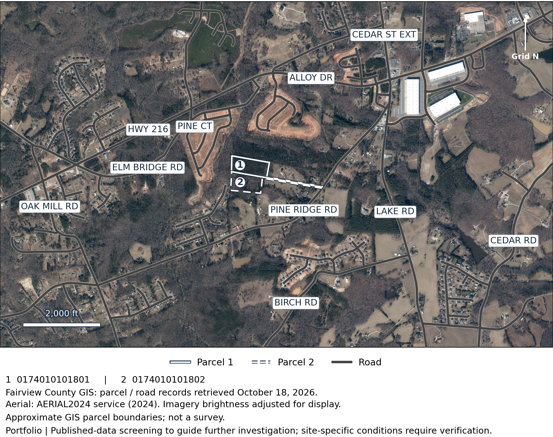
Two complete county GIS parcels are screened together, with their shared boundary and road strips retained.
Key takeaways
- 20.39 county tax acres; 20.54 calculated GIS acres. Next: Confirm the sale plat, parcel list, acreage and access rights. Inclusion of both parcels in the advertised sale remains unconfirmed.
- Solid and dashed outlines distinguish Parcel 1 and Parcel 2. Next: Use the same confirmed boundary in planning, utility and field-review requests.
Download the full report: property details and acreage reconciliation.
Zoning and Future Land Use
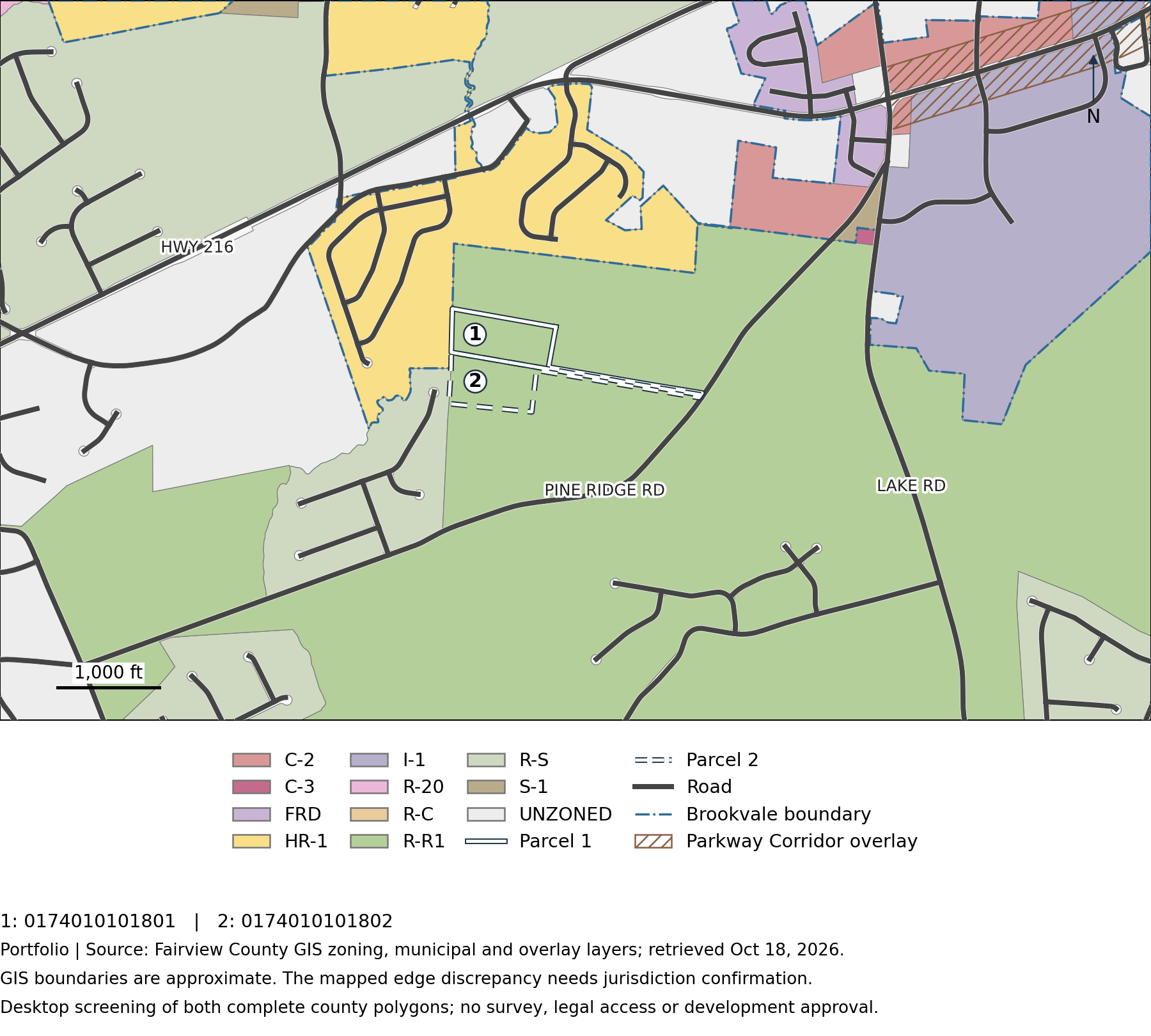
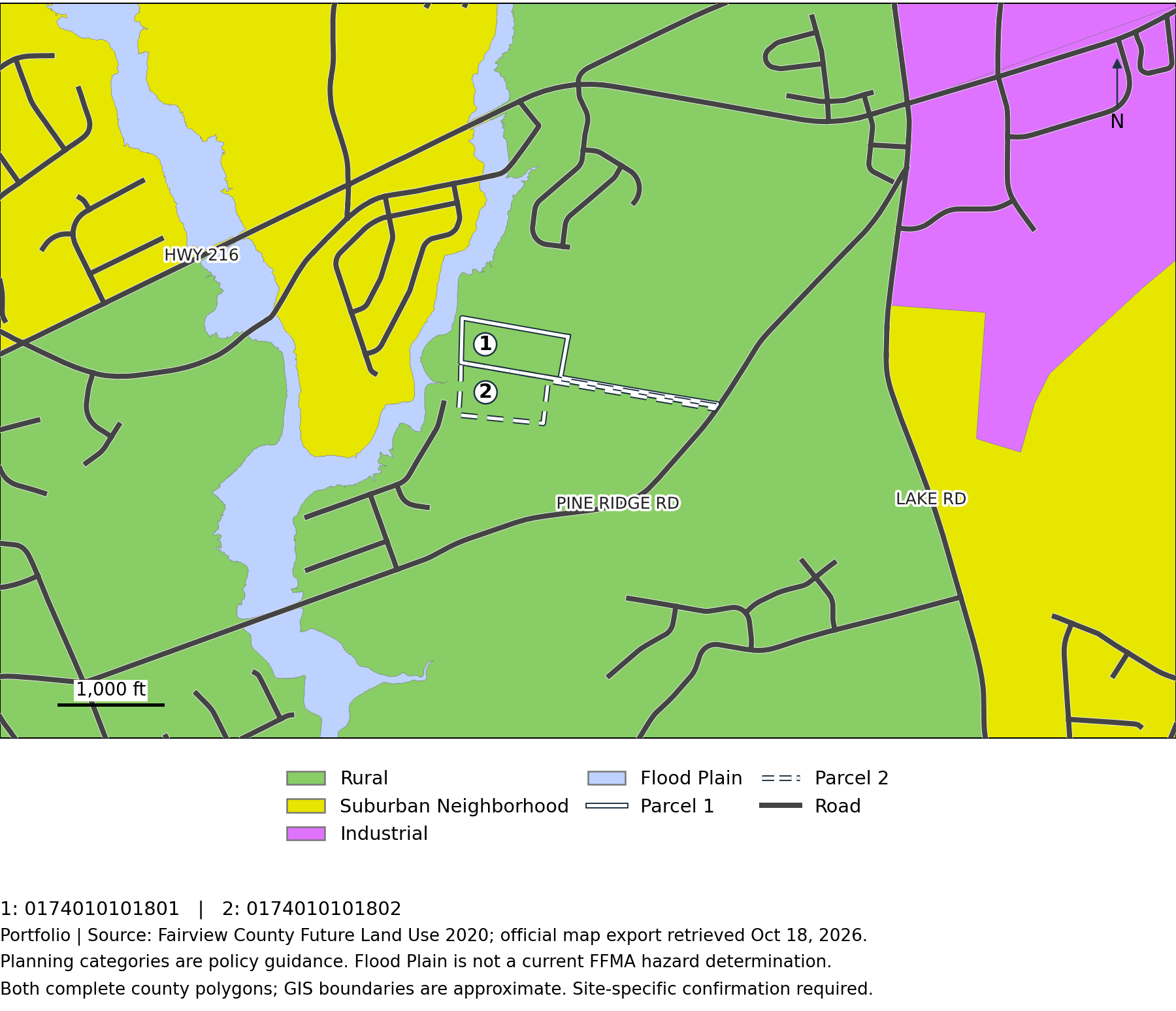
Almost all of the property is mapped R-R1; both parcels fall within the county’s Rural future-plan designation.
Key takeaways
- Conventional R-R1 zoning has a one-acre minimum; Rural plan guidance recommends one dwelling per two or more gross acres. Next: Discuss both with planning staff. Neither figure establishes an approved home count.
- Tiny R-S and city HR-1 intersections occur at the mapped edges. Next: Confirm jurisdiction and zoning for both parcels and road strips before relying on subdivision standards.
Download the full report: planning standards, jurisdiction details and designation tables.
Wetlands and Surface Water
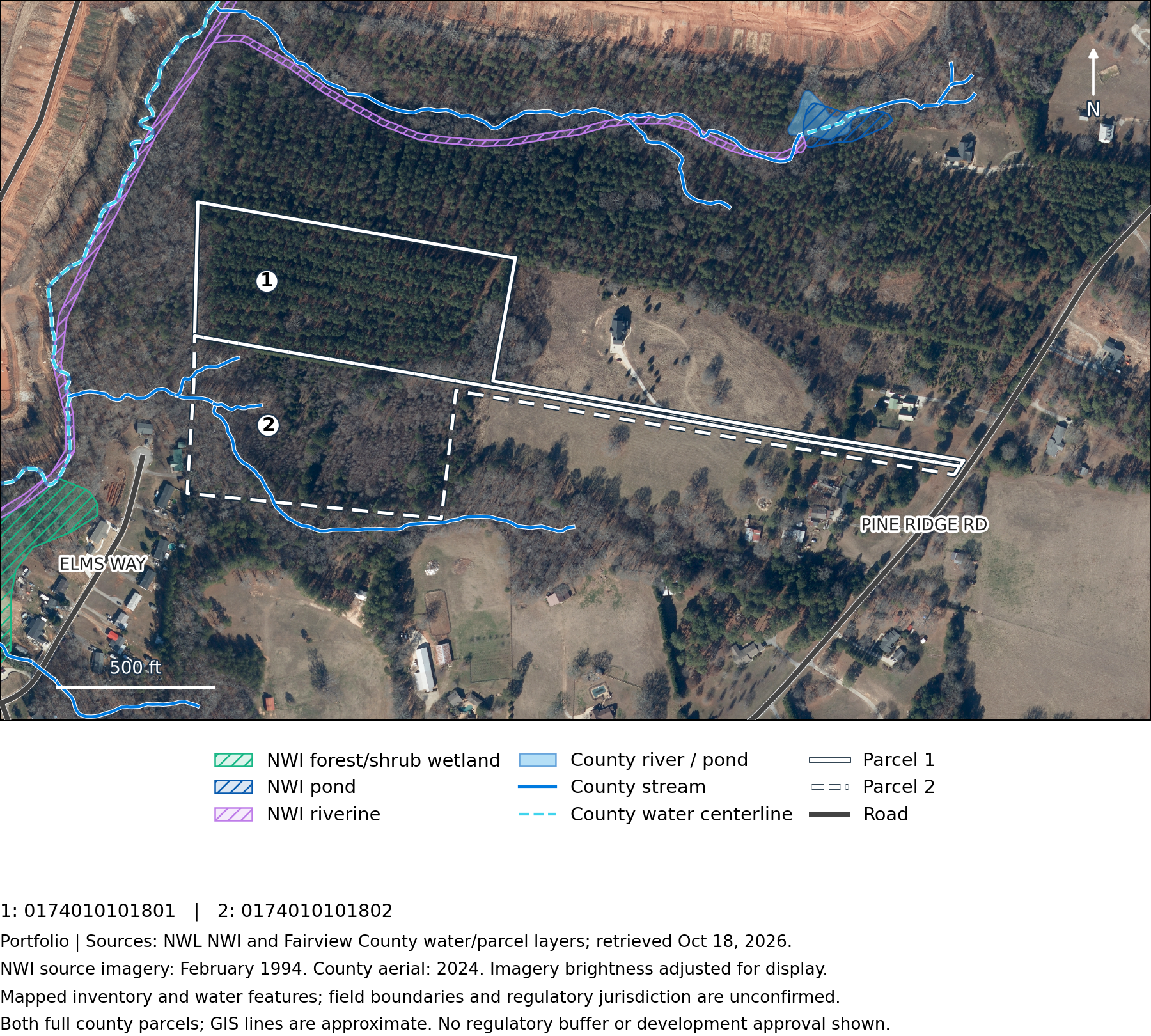
County stream linework crosses Parcel 2, although mapped wetland-inventory polygons do not overlap either parcel.
Key takeaways
- Inventory imagery dates to 1994; the aerial context is labelled 2024. Next: Have a qualified professional locate streams and potential wetlands before defining crossings, roads or clearing limits. Zero mapped overlap does not establish absence.
Download the full report: water-feature records, source dates and map guidance.
Flood Hazards
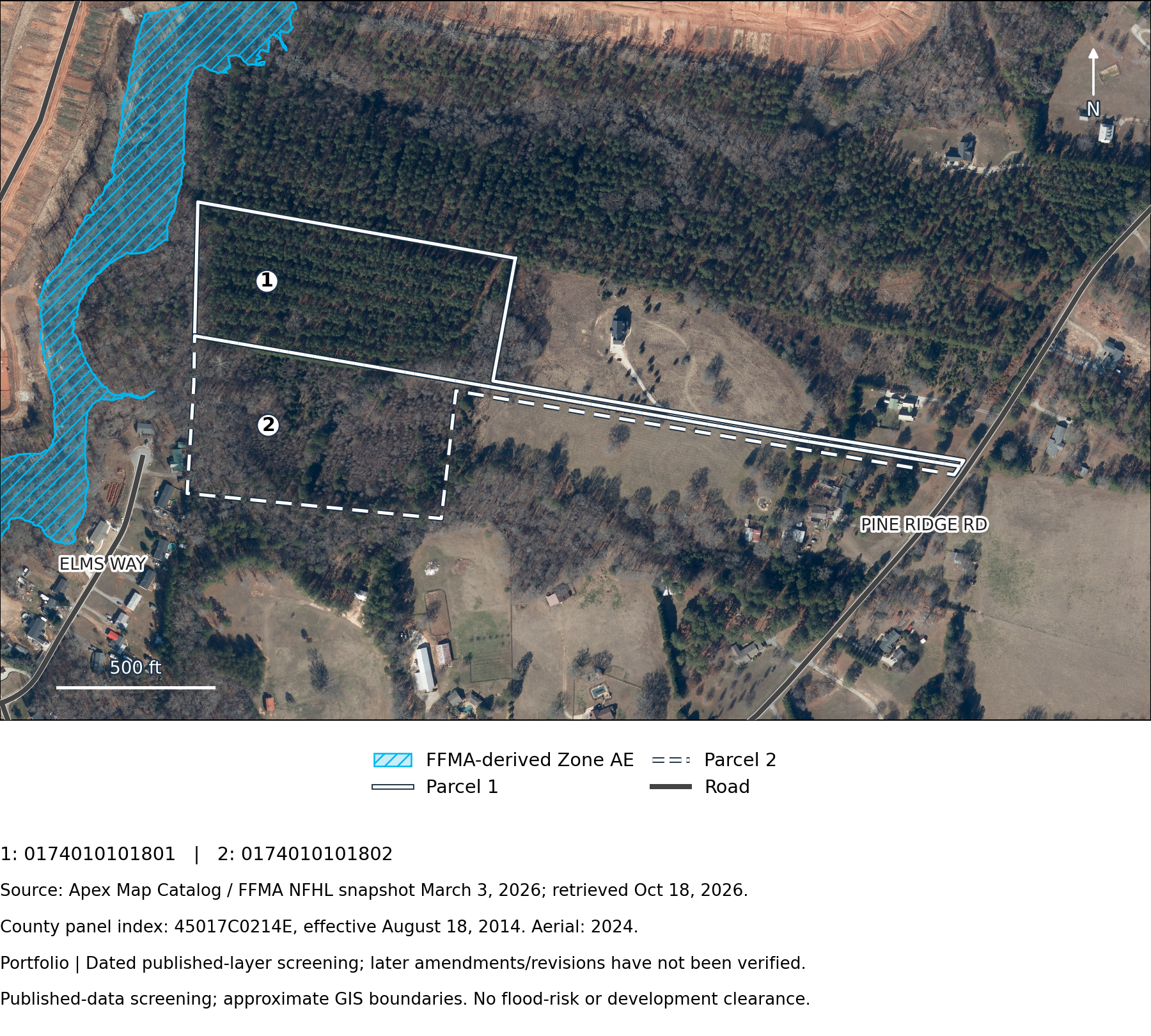
The March 3, 2026 published flood-layer snapshot shows Zone AE nearby without overlapping either parcel.
Key takeaways
- State and county layers show the same general pattern; the original effective panel and subsequent map-change history were not independently verified. Next: Obtain current effective records and applicable letters. Review Parcel 2’s stream corridor and local drainage separately; no Zone X assignment is made.
Download the full report: flood records, dates and verification limits.
Terrain and Slope
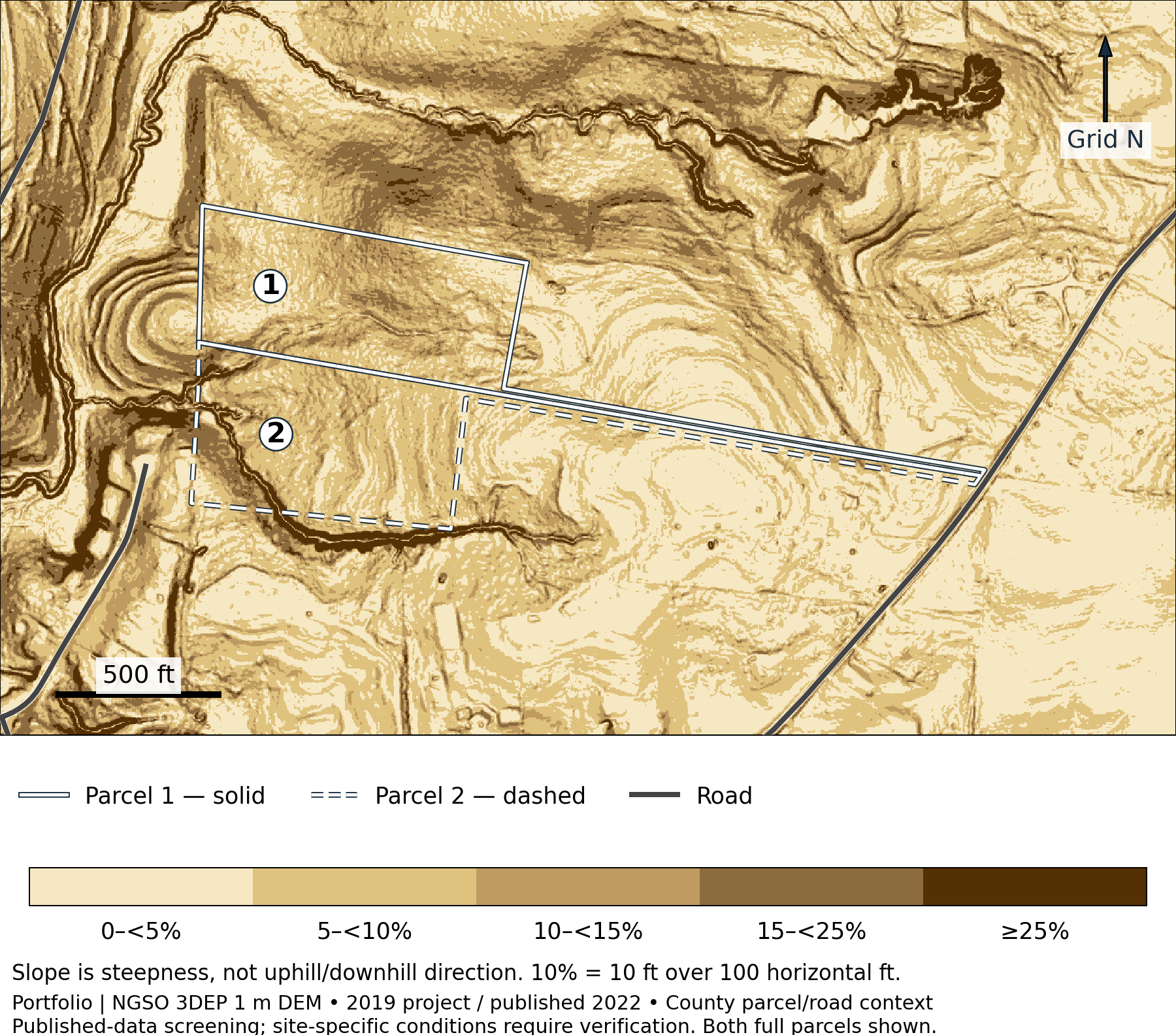
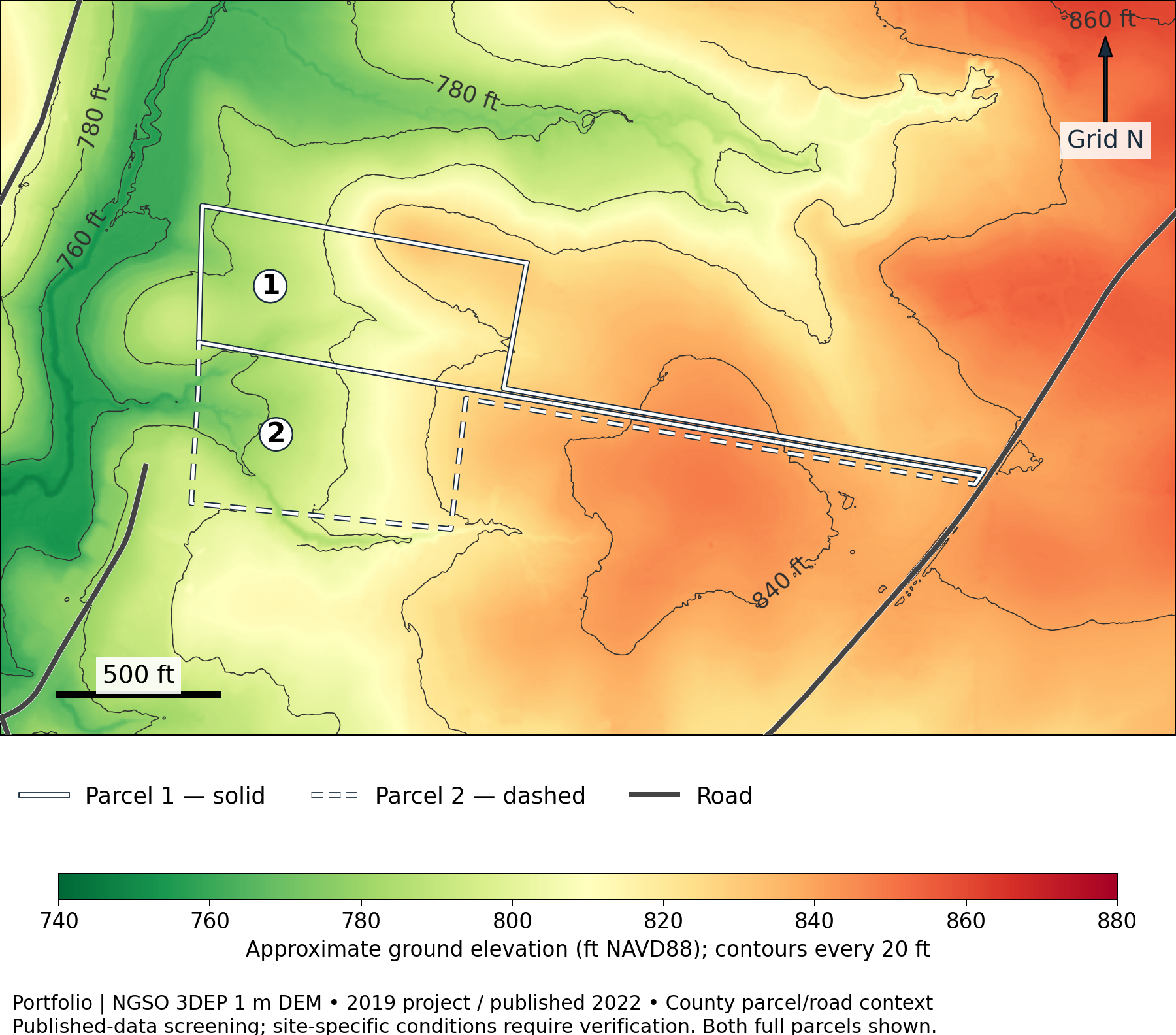
Most modeled land is below 10% slope, with steeper patches on both parcels.
Key takeaways
- Approximately 1.80 combined acres are at least 15% slope; Parcel 2 contains more land in the 25% or steeper class. Next: Use topographic survey and civil review to evaluate access, drainage and grading.
- Modeled elevations range about 771–845 feet on Parcel 1 and 766–846 feet on Parcel 2. Next: Confirm actual elevations before setting building levels or earthwork assumptions.
Download the full report: slope acreages, elevation data and map-reading guidance.
Water Supply and Wastewater Screening
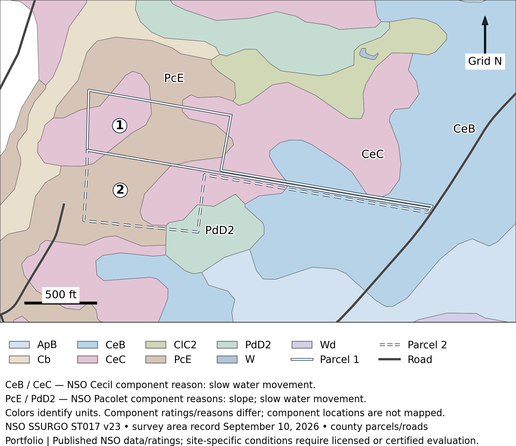
Public water and sewer availability remain unconfirmed for both parcels and the proposed housing project.
Key takeaways
- Published septic ratings include Somewhat limited and Very limited components. Next: Obtain written utility responses and have qualified professionals evaluate private alternatives.
- Nearby historical well records do not establish an on-parcel well, yield or water quality. Next: Obtain owner and agency records; investigate wells, primary and replacement septic areas, buildings and streams together.
Published Soil Data — Further Investigation Required By Licensed or Certified Professional. Published survey mixtures and reference ratings require site-specific evaluation.
Download the full report: utility findings, fee context, well records and septic component tables.
Soil Wetness and Drainage
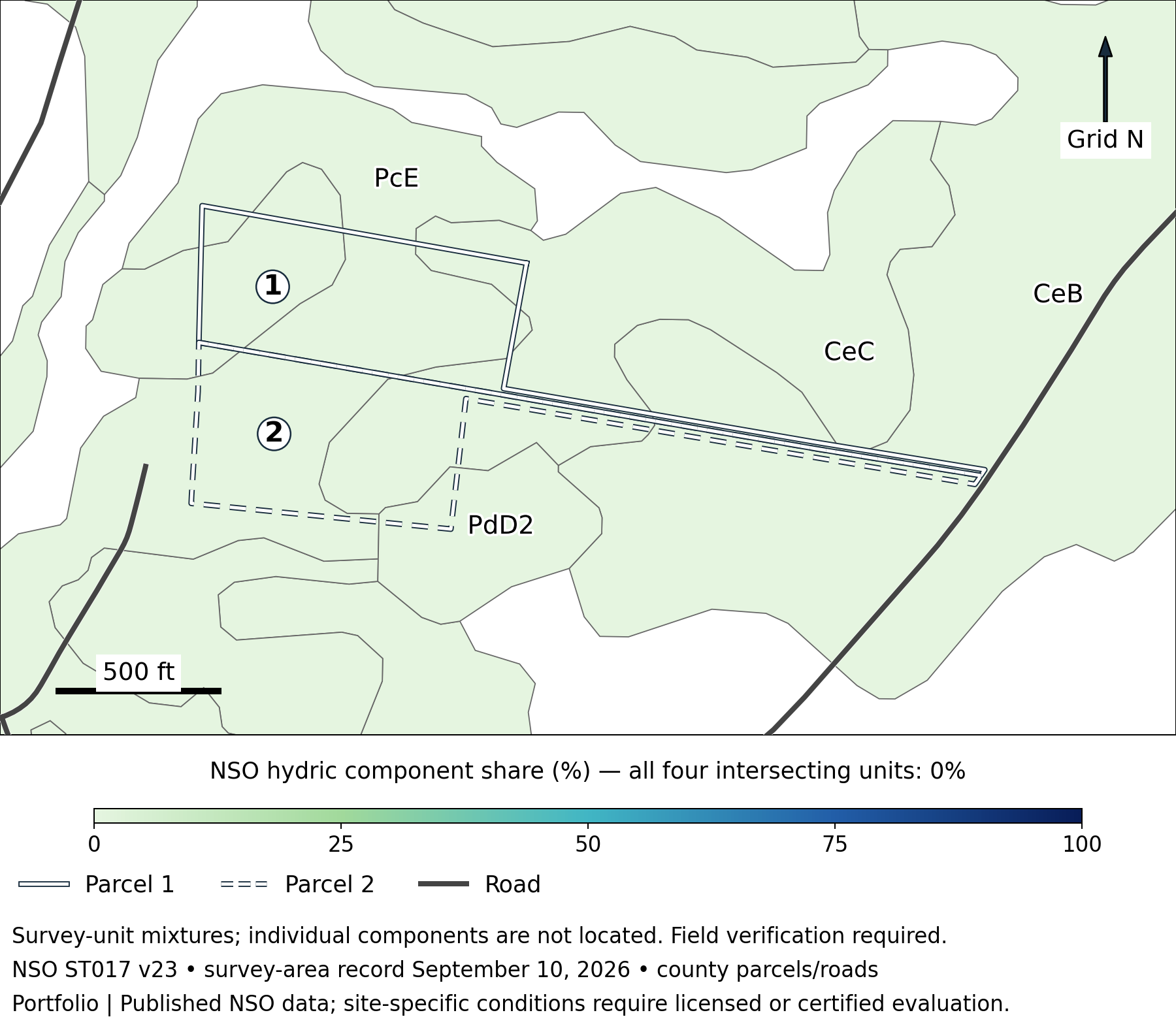
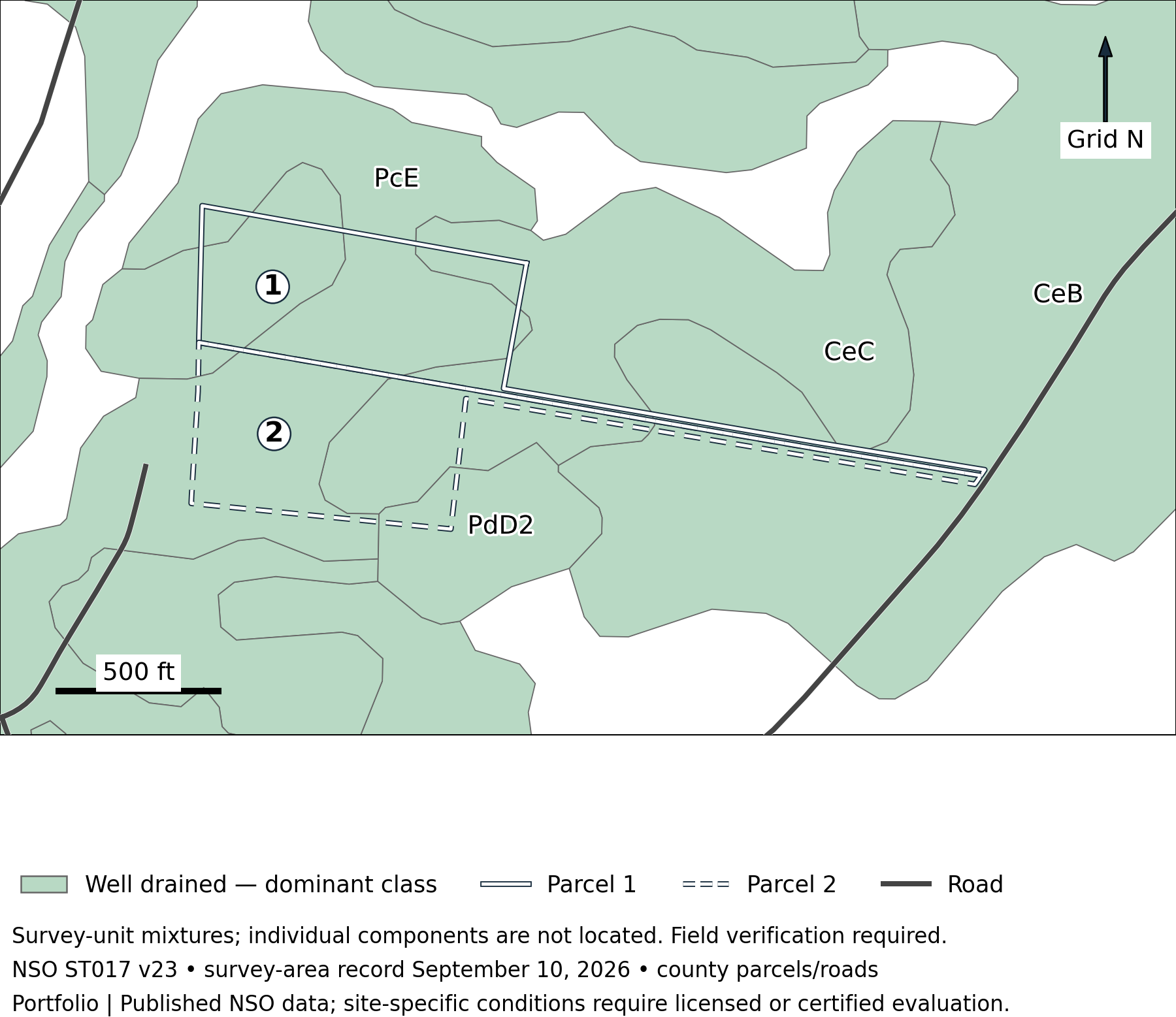
All four intersecting soil-survey units have 0% published hydric-component shares and dominant Well drained classifications.
Key takeaways
- CeB and CeC also contain small Moderately well drained components. Next: Investigate local wetness and stream/drainage features onsite. Nonhydric mixtures do not establish that wetlands or seasonal wet spots are absent.
Published Soil Data — Further Investigation Required By Licensed or Certified Professional. Published survey mixtures and reference ratings require site-specific evaluation.
Download the full report: soil-component percentages, drainage and monthly wetness records.
Building Soil Conditions With and Without Basements
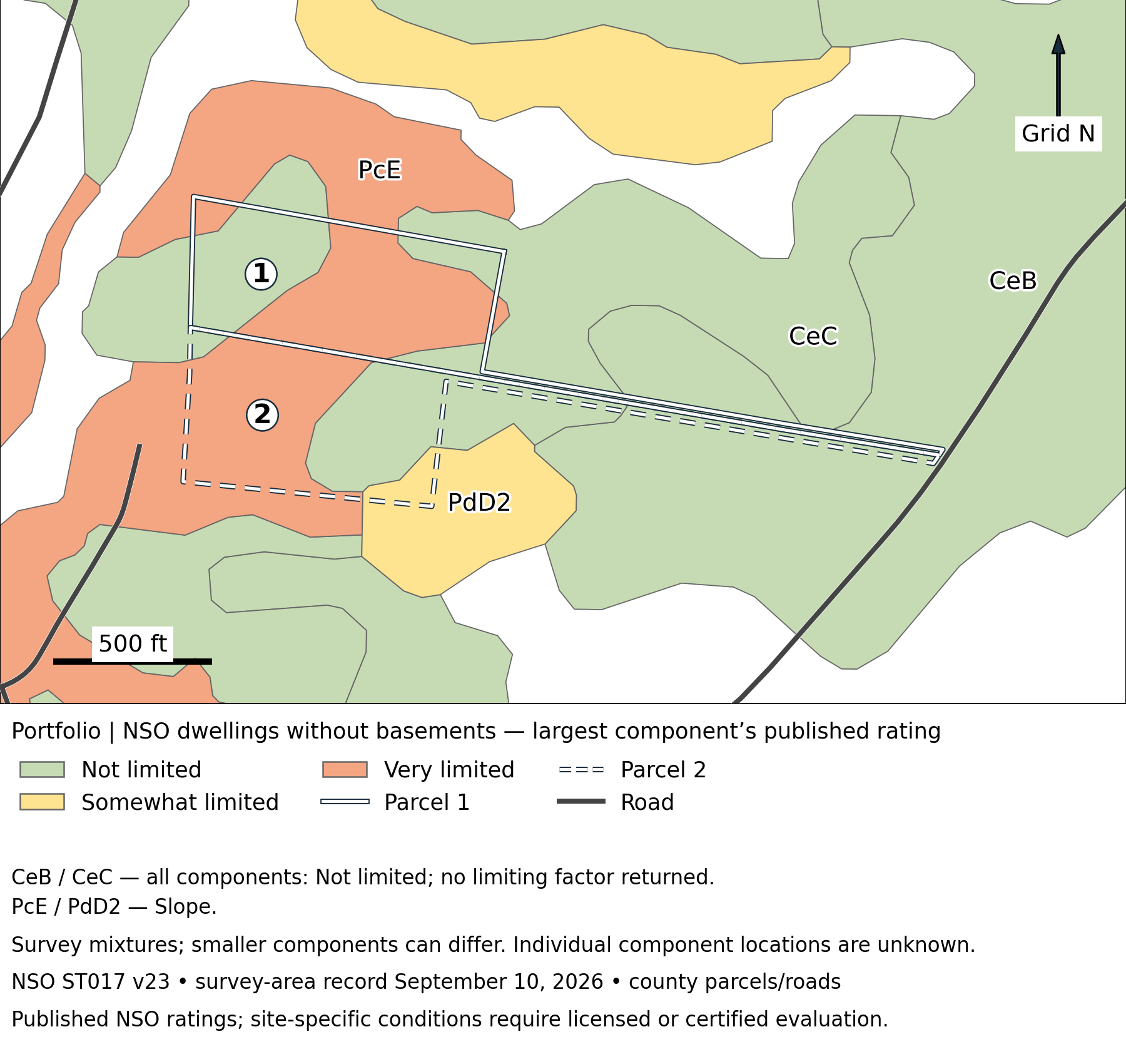
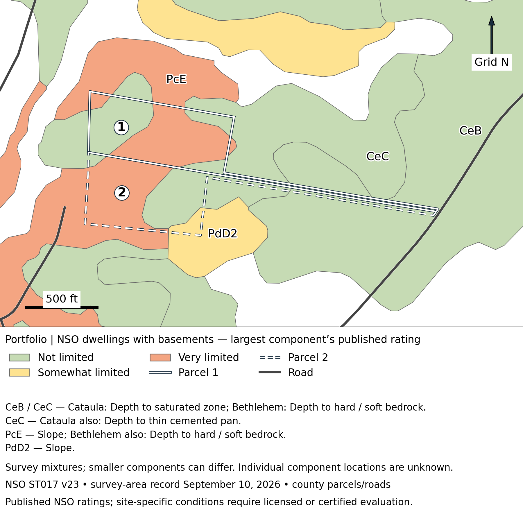
Largest-component ratings match in the two foundation scenarios; smaller components add basement-related factors.
Key takeaways
- PcE components are Very limited for slope; PdD2 is Somewhat limited. CeB and CeC have favorable largest-component reference ratings. Next: Scope geotechnical investigation for actual ground conditions, foundation depth, rock and moisture. Published ratings do not locate suitable building sites.
Published Soil Data — Further Investigation Required By Licensed or Certified Professional. Published survey mixtures and reference ratings require site-specific evaluation.
Download the full report: foundation reference scenarios and complete component ratings.
Clearing and Erosion
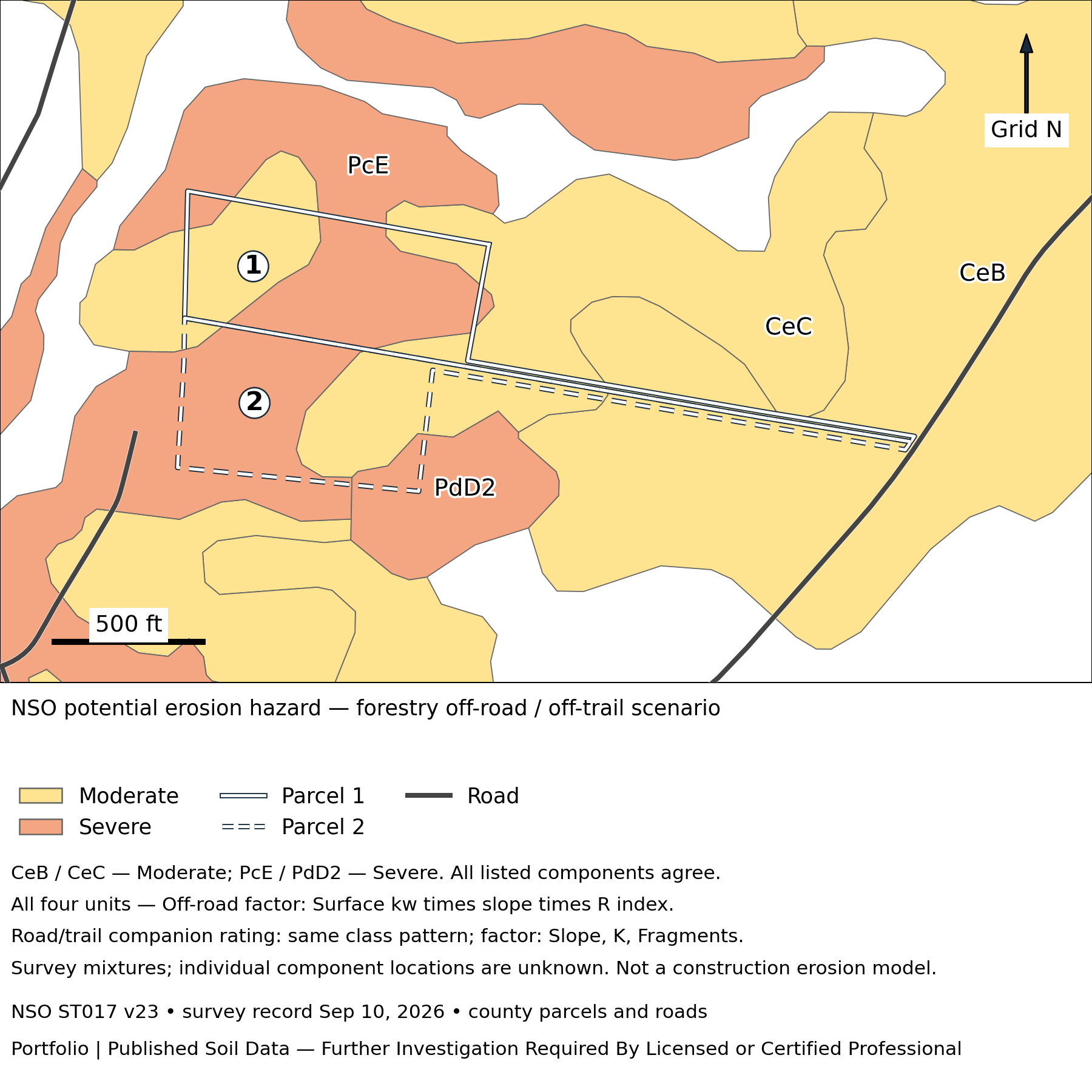
Published forestry erosion ratings are Moderate in CeB/CeC and Severe in PcE/PdD2.
Key takeaways
- Tree cover and the Parcel 2 stream corridor create clearing and drainage questions. Next: Coordinate construction access, vegetation retention and stabilization with civil and soil professionals. Forestry reference ratings do not predict construction sediment loss.
Published Soil Data — Further Investigation Required By Licensed or Certified Professional. Published survey mixtures and reference ratings require site-specific evaluation.
Download the full report: erosion reference scenarios, factors and component tables.
Wildlife and Habitat
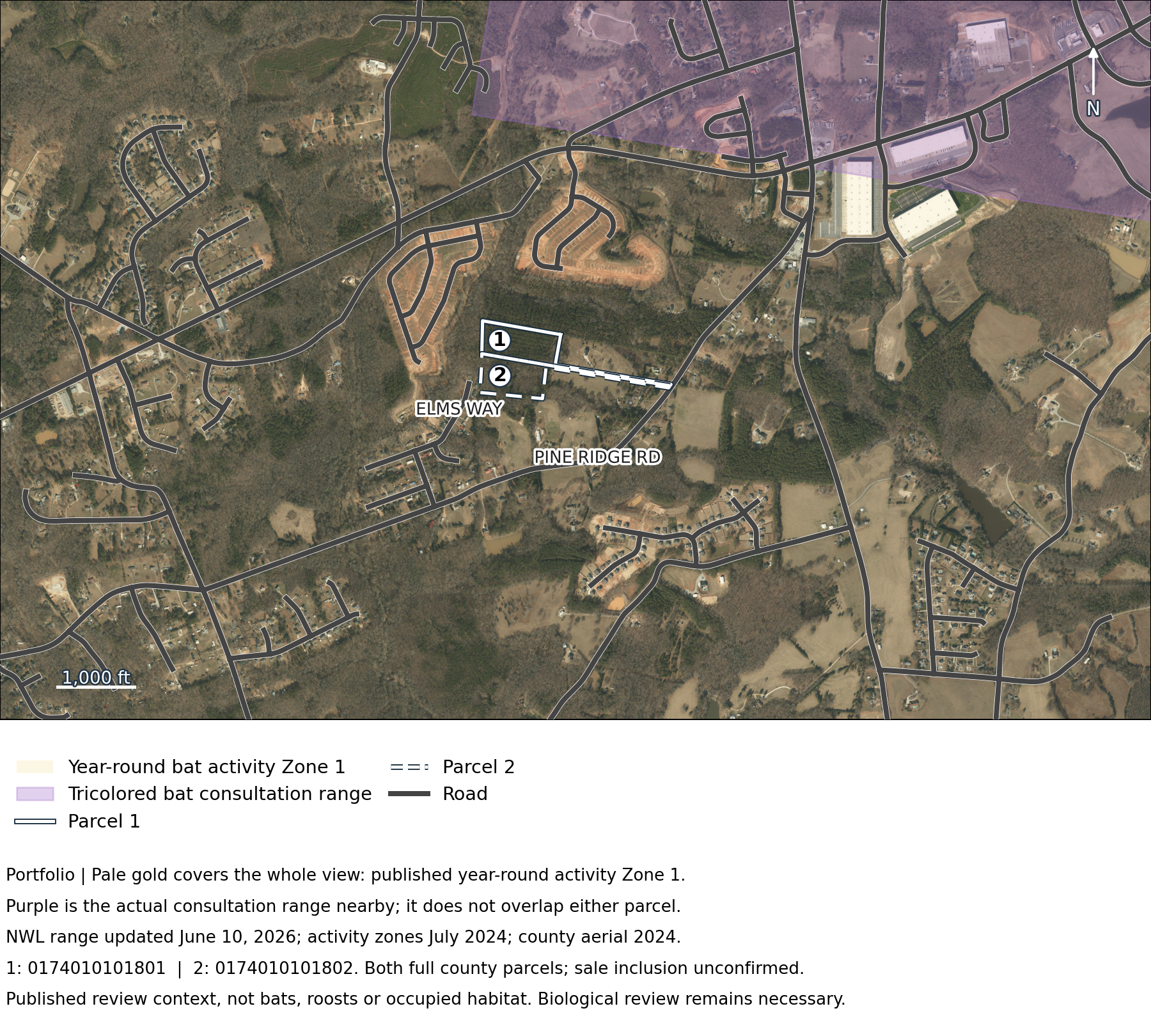
Both parcels lie in published year-round bat activity Zone 1. A separate tricolored bat consultation range is nearby but does not overlap either parcel.
Key takeaways
- Regional activity zones and consultation ranges do not establish animal presence or absence. Next: Have a biologist review the complete action area, habitat, clearing and agency-review needs before relying on a clearing schedule.
Download the full report: species checks, range definitions and source limitations.
Local Policies and Special Constraints
The queried special-overlay and public heritage maps show no parcel overlap; nearby records identify additional questions.

Key takeaways
- A nearby cleanup point represents five related entries, including Closed with Restrictions; the Parkway Corridor overlay lies outside both parcels. Next: Have environmental and title professionals review relevant files and restrictions. Proximity alone does not establish contamination or an overlay requirement on Pine Ridge.
Download the full report: environmental case records, overlay details and source checks.
Ground Hazards
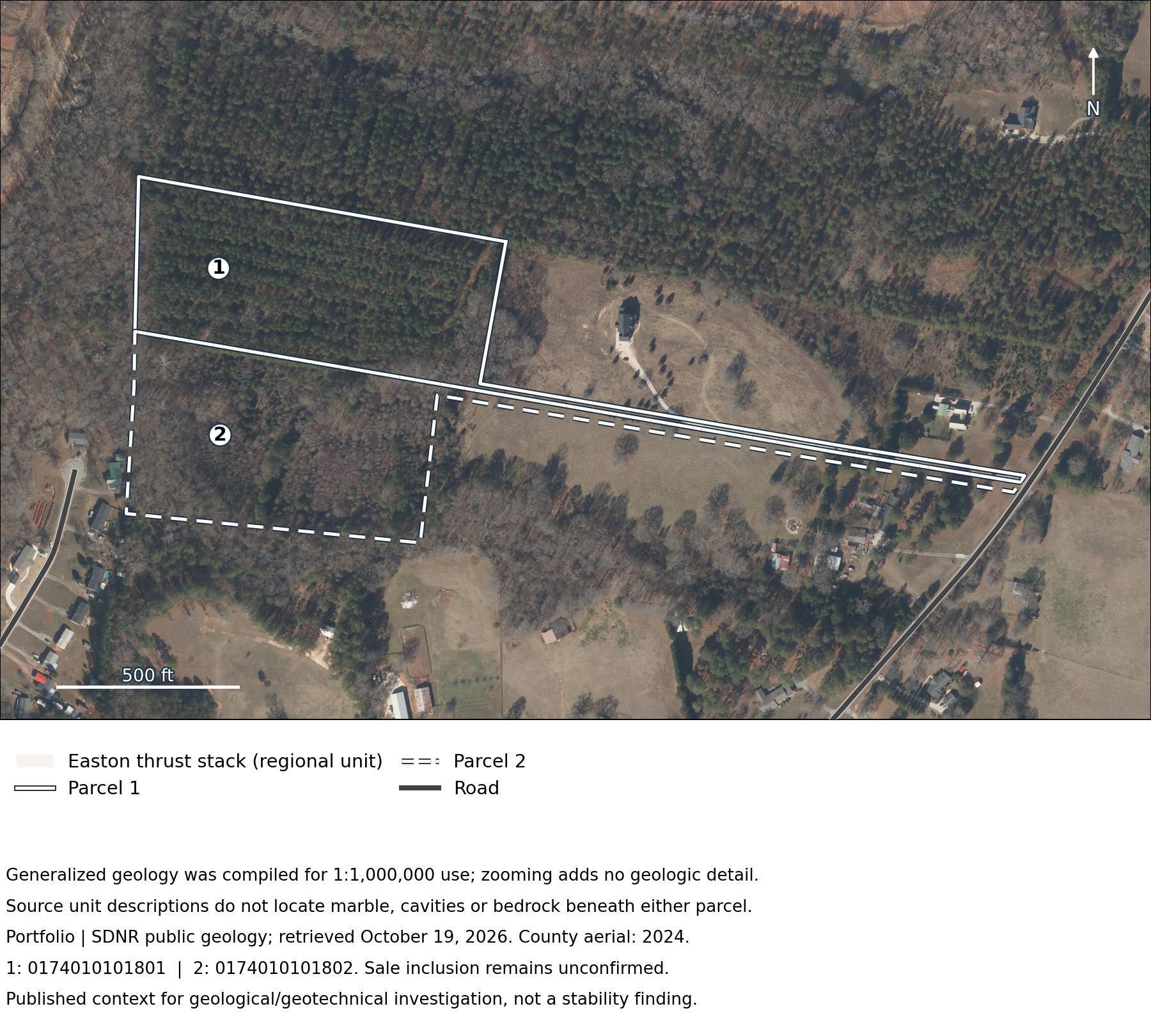
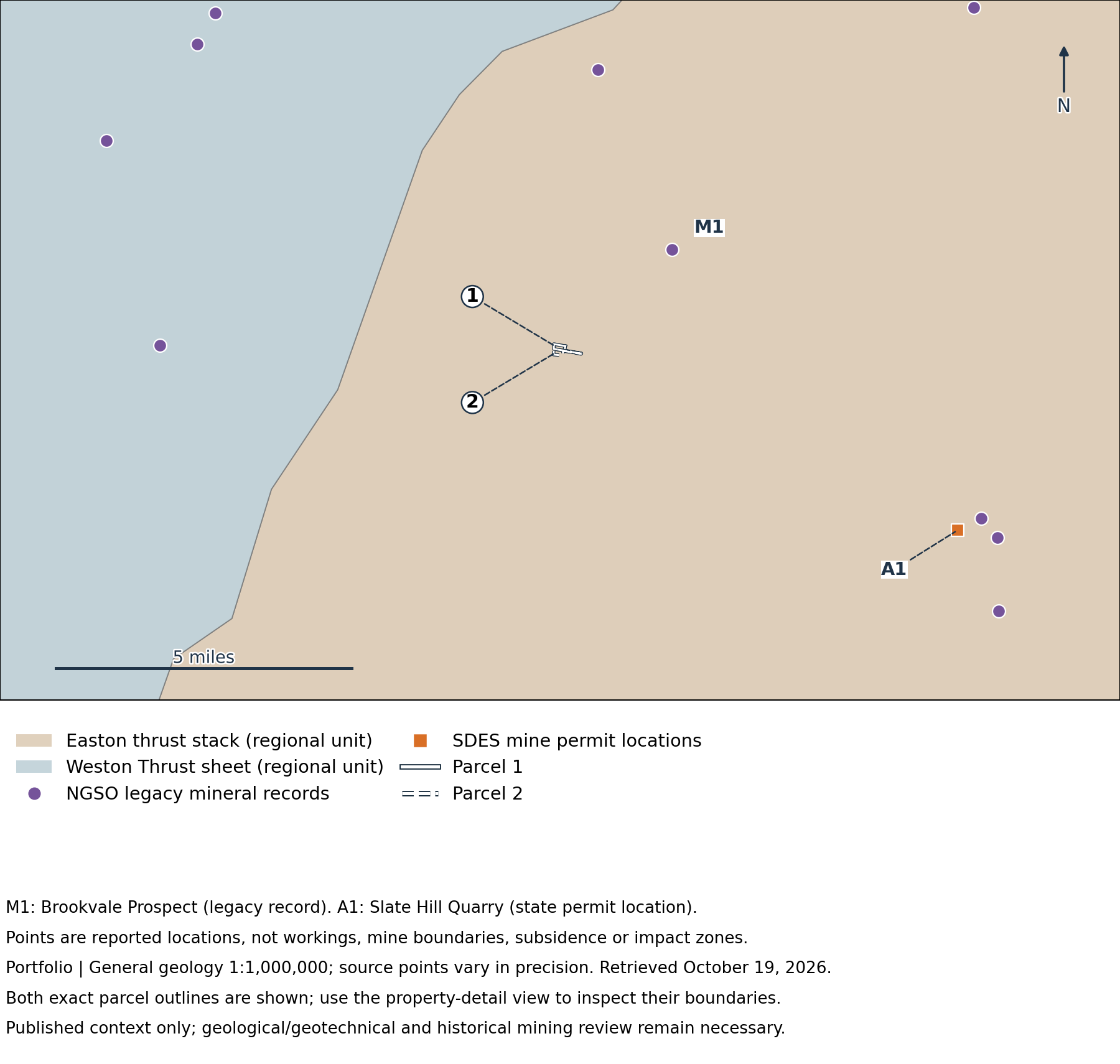
The generalized regional geological unit includes small marble bodies somewhere in its extent; it does not locate marble beneath Pine Ridge.
Key takeaways
- Regional geology and nearby mineral records cannot establish site stability or underground workings. Next: Have a geologist or geotechnical professional assess actual rock, groundwater, fill and any carbonate or cavity concerns before foundation or excavation decisions.
Download the full report: regional geology, mineral records and inventory limitations.
Surrounding Land Use Compatibility
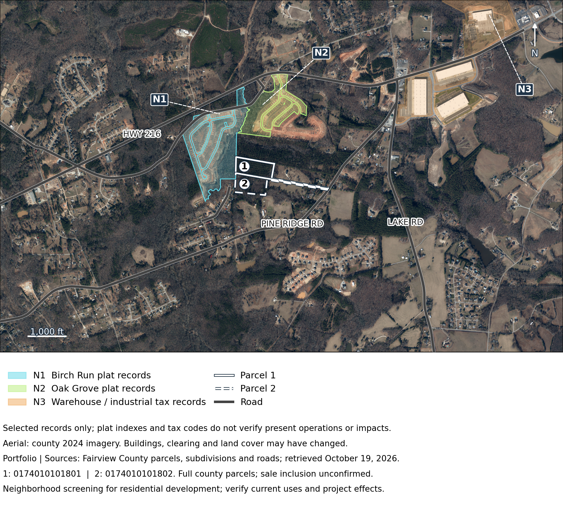
Nearby records describe homes, agricultural land, association property, subdivisions and selected warehouse/industrial-coded parcels.
Key takeaways
- Subdivision indexes and historical imagery do not establish current buildout, access rights or measured effects. Next: Confirm current projects, occupants, operating hours and delivery routes; discuss screening and any specialist reviews needed.
- The electric supplier and project service capacity remain unconfirmed. Next: Identify the responsible provider and request project-specific connection and extension information.
Download the full report: neighboring parcels, subdivision records and service contacts.
Actions and Next Steps
Priority indicates investigation sequence, not severity. Begin Priority 1 records and provider reviews in parallel.
Priority 1
Confirm the sale area, title and access rights; reconcile planning jurisdiction; obtain utility responses; and review the nearby environmental records.
Priority 2
Verify streams and flood records. Coordinate topographic, soil, geotechnical, geological and habitat investigations, and confirm current neighboring activities.
Priority 3
Use those answers to refine and cost the residential concept, including grading, construction access, vegetation retention and disturbance controls.
Download the full report for the complete action briefs and property contacts.